Port Douglas to Sydney

Leaving port douglas

We have, at last, managed to get ourselves in gear and are back on the road.  Although the last 4 months in Port Douglas have been idyllic, it is exciting to be moving again, particularly so given the decisions we have now made to exit Australia.  An inspirational quote popped up on FB the other day – ‘the only impossible journey is the one not started’ and whilst I would agree whole-heartedly with the sentiment I would add a caveat that ‘If something isn't working, don't try harder or do more, try something different’.  Despite our very best efforts to make the transition from Oz to SE Asia with Bob and the more problematic Leroy, we kept coming up against issues that no matter how much we tried to navigate our way around them, just left us right back where we started.  At the time of writing, most of SE Asia was still not open for tourism and there has been little or no news as to when this will change broadscale.  After a particularly frustrating week making no progress whatsoever, we decided to broaden our horizons and determine what other options were open to us - just about the time that England lifted all restrictions in what many considered to be a bold move in living with Covid.  In some respects, getting all of us to the UK is an obvious, easy choice and the only real downside is the 6 week shipping schedule for Bob.  Timing-wise, we would be heading into UK and Europe at the beginning of Spring, we could catch up with family and friends and, whilst waiting for Bob to arrive,  walk the 320 km Coast to Coast path.  Quick show of hands/paws and, yes, we have a plan, one that includes Qatar and Qantas Airlines and OOCL Shipping.

port douglas surrounds

We have given ourselves a month to make the 2,600 km journey from Northern Queensland to Sydney which should give us plenty of time to enjoy the drive down whilst allowing a bit of flexibility for any delaying issues that hopefully won’t arise.  The day before we were due to leave PD, the weather decided to have a last summer blast and the temperature rose into the high thirties, accompanied by sticky humidity and swarms of biting insects.  Great, just what we wanted when leaving the luxury of air-con and getting ready to camp our way to Sydney.  So, rather than head straight down the coast as originally intended, we headed inland and back up to the Tablelands hoping to find slightly cooler conditions.  I think too, that having spent so long in PD and after an accumulation of many hours on 4 Mile Beach we were looking forward to some different scenery.  An event worth mentioning – we have waded thigh deep through the ocean every day for over 4 months and, despite numerous warning signs, have seen no sign of any crocodiles nor marine stinging jellyfish.  Until our penultimate day!  As we were progressing slowly through the calm shallows we came across a couple of jellyfish and not knowing what type they were or whether they were outliers of a larger group, we exited the ocean and continued our walk along the sand.  The following day we read that a 14 year old boy had died after getting stung just a couple of hundred kilometres further down the coast.  I guess you really do need to be aware of the possible consequences when going into these tropical waters.

As hoped, the Tablelands were as lush as we recalled from our previous visit back in September and we enjoyed hiking up Mt Baldy before our first night camping in the grounds of Ravenshoe Golf Club.  Ravenshoe is a typical Tablelands small town with a laid-back vibe and very pretty scenery and does have a couple of accolades – it is the highest town in QLD with an elevation of 930 m and it also claims to be the beard capital of Oz.  As we were staying in the secluded grounds of the Gold Club we are unable to testify to the town's claim of many bearded men (and possibly women) but we enjoyed the lower temperatures that accompanied out height gain.  If not for the hordes of marauding midgees it would have been pretty perfect although these annoying insects do guarantee an early night. 

oh!

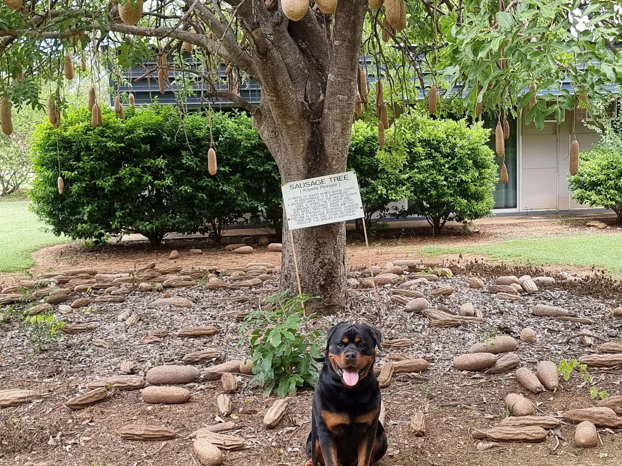
Our route was to follow the Inland Way as far as Rockhampton (1200 km) and once out of the tropical north to continue down the coast towards Sydney.  Leaving Ravenshoe, our aim was to drive about 175 km a day thereby giving us plenty of time for exploring, finding some good walking tracks and also get in some cycling – we had the idea of one of us driving while the other cycled for about an hour each day.  It was a bit of a surprise therefore when, by 11am the next morning, the temperature was sitting at 39°C!  Admittedly, the humidity had gone but any sort of activity was clearly out of the question and our only option to avoid the searing heat was to drive... and drive.... and drive.  Bob ate up the kilometres through the Central Queensland Highlands and through great swathes of uninhabited outback, any excitement during the day provided by our arrival at a roadhouse or tiny town – the average populations of which seemed to fall between 5 and 10.  I think we saw about six other vehicles on the road all day.  Bob's air con struggles a bit once outside temperatures get into the 30’s and packed full of gear, two perspiring adults and a panting 50kg dog, the interior was more than a little funky.   Of more concern was the fact that I could feel the heat of the accelerator pedal through the sole of my sandals and really didn't want to focus on how hot the tyres must have been.  It would have been an absolute nightmare to have any sort of mechanical failure and I struggled not to play with that possible scenario just in case I somehow brought about its eventuality.  Not wanting to stop for the night until the temperatures had dropped we eventually pulled off the road into an abandoned gravel pit at 7pm and were amazed that the temperature was still nudging 40°C.  After dinner, Ian was the first into our roof-top bed and when asked how hot it was up there he replied “it's ok as long as you don’t move".  We consoled ourselves by agreeing that as hot as it was it would surely be hotter and more uncomfortable had we taken the coastal route and we had definitely made the right decision to come this way.  The following day was worse, the temperature was in the 40s by mid morning.  As the day progressed, we passed through tiny rural towns including the small community of Greenvale, Outback Qld where we stopped at the Green Rivers pub and were somewhat surprised to find a sausage tree in their back garden.  This tree is Kigelia pinnata a central and southern African native, found occasionally in Australia, that after rain produces one of the most unusual flowers of any of the world's trees.  The flowers appear like hanging clusters of orchid flowers, each individual flower about 10cm across, dark maroon in colour and of a velvety texture.  We were too late to appreciate any flowers that the tree might have produced but we did see numerous, large, sausage-shaped woody fruit.  These woody fruits are up to an impressive 60 cm long, weighing in at around 7 kg.  Although the unripe fruit is poisonous, it is known to have been used in Africa as a treatment for rheumatism and also as a dressing for tropical ulcers.  Given the rarity of these trees in Australia we were pretty impressed whereas Leroy was understandably disappointed.

gravel pit camping

A part of our journey that should have taken a leisurely week had taken 2 days and we arrived in Rockhampton too early to collect the pre-ordered new Samsung phone that was due to be picked up from JB HiFi.  To fill in the extra time we drove into the seaside town of Yeppoon and booked into a Air bnb with much needed air-con.  Talking to the owners we were informed that the extreme hot weather was unusual and the hottest on record and was part of the weather pattern that was causing flooding to parts of south-east QLD and NSW.  Despite the sweltering heat, we enjoyed Yeppoon for a couple of days and after collecting the new phone were back on the road.   This was the first time that I had pre-ordered a new mobile and it was a surprisingly heady experience to take ownership on the very first day of release.  Unfortunately, the slightly larger size required a new RAM car cradle and therefore a visit to Johnny Appleseed in Brisbane was on the cards.

central queensland coast

Once past Rockhampton we expected the temperatures to drop a bit as we again crossed the Tropic of Capricorn, this time going from the tropics into the sub-tropics.  As such, during our two day drive to Rockhampton we had identified a couple of 15 km walking trails at Tannum Sands which we thought would be good training for our up-coming Coast to Coast walk.  No such luck, the oppressive heat was on-going and we only managed a quick, but pretty, there and back 3 km track through Canoe Point Recreation Park.   We had planned to stay a couple of nights nearby and had found a great spot on the flood plain on the banks of the Boyne river.  Picturesque for sure, but not a single tree for shade and so we carried on south and spent the night 30 km short of Agnes Waters/1770 at another gravel pit.   You could be forgiven for thinking that camping in a gravel pit is really the pits (groan), but they do make for good overnight stops.  Surprisingly, there is rarely anyone else there, they are completely flat and they are usually far enough away from the road that you get a good night's sleep.  We were even treated to an amazing lightning display that lasted for a good five hours and, given it was coming from the direction that we were heading, boded well for a cooler change.  Ian drove into the twin towns of Agnes Waters and 1770 the next morning whilst I took the opportunity to cycle in.  These small oceanfront towns line the northern-most of Queensland’s surf beaches, and are often described as ‘last in a line of beautiful unspoiled beaches that sweep up the coast from Bundaberg’, and yes, like much of the Queensland coast they live up to their reputation but the secret is definitely out as the place was packed.  The caravan park was overflowing and the nearest place for a wild camp was back at the gravel pit.  We had some lunch at a small cafe, which was literally on the beach, before deciding it was all too busy for us and piled back into Bob.  Unlike other parts of Australia that we have visited, the Queensland coast offers little scope for free camping and once past Bundaberg, and not wanting to stay in a caravan park, Ian consulted WikiCamps and found Wyper Scout park, a large bush area on the banks of the Burnett River.   This turned out to be a real stroke of luck as on our second night there the rain finally came with swirling winds, ear-splitting thunder and dramatic lightning.  Able to take advantage of one of the scout shelters, we unpacked our waterproofs and sat it out.  Without the shelter, which was keeping us and everything we now own, out of the worst of the weather, it would have been a challenging night.

By now, we were a bit over the extremes of weather and being a lot further south than we had anticipated we pointed Bob towards Noosa and another Air bnb.  Even this simple act was prone to difficulties as many of the roads were closed as a result of flood waters over the previous week.  We were frequently turned back, on one particular instance we had travelled for 45 min along a road only to find a barrier preventing further progress and the only option being to go all the way back along the way we had just come.  Another road was closed as the entire bridge had been washed away and many other roads were undergoing big clean-up operations.  We made slow progress in ever increasing circles until eventually reaching Noosa.  We had been to Noosa before and not wanting to compete with the crowds, stayed a couple of km away at Sunshine Beach which, unfortunately, was not living up to its name as it was now raining, pretty much non-stop.

scenic rim adventure park

Sunshine Beach is a great alternative to busy Noosa, a relaxed, friendly place with an easily accessible long sandy beach which was, for the most part, pretty much deserted which may or may not have been as a result of the rain.  We stayed a few days and enjoyed exploring the area on our bikes despite the heavy showers and heart-pumping hills that were impossible to avoid.  We walked a section of the 90 km coastal walk that links south south Caloundra and Noosa which took us through small areas of bushland atop the ocean cliffs affording great views of the surrounding coast.  The return route was back along long sandy beaches with some occasional rock scrambling in order to get around the small headlands.  It felt good to do a decent length walk, as preparation for our upcoming long-distance UK hike has been, so far, non-existent.

There is no denying that the eastern Australian coast is stunningly beautiful, but there is a definite sense of Groundhog Day as you pass from one seaside town to the next, each one seemingly more busy than the last one and so we once again turned inland and continued our journey towards Sydney through some of the most beautiful countryside that we had seen so far.  Green rolling hills stretching as far as the eye could see, interrupted by patches of pine forests and pretty, rural towns.  We meandered along narrow winding roads enjoying the spectacular scenery, bright cloudless skies and perfect temperatures under 30°C.    

pokolbin forest

Our route took us through Eumundi (renowned for its fabulous markets) and Maleny before crossing the border into NSW where we passe through Alstonville, Deepwater, Armidale, Tamworth and Muswellbrook.  Overnight stops included showgrounds, farm stays and the excellent Scenic Rim Adventure Park (if you are at all into 4x4 driving tracks, private quiet campsites with stunning views, this would be your place).  The showgrounds, a constant in many Australian towns, offer great, clean facilities for an overnight stay.  They do not usually require a pre-booking and, at the end of the day, when nothing else has presented itself, it is a relief to drive through their gates.  Ordinarily there would be plenty of room to set up camp but a couple of times, due to the grassed areas being too wet to drive on, everyone staying was crammed into a compact car park area where you are at the mercy of your neighbours to determine whether the stop-over is good, bad or ugly.  However, it was nice to see the various showgrounds being well utilised and in many of the rural towns we drove through it was apparent that they are very much at the centre of the local communities.  We have been entertained with greyhound racing, harness racing and, best of all, taken on a private tour of Tamworth's rescued fire engines.  Should you ever find yourself in the vicinity of Tamworth do go and talk to the group of men restoring these vehicles.  The group is made up of retained, retired and permanent firefighters, many of whom have suffered from PTSD, who get together to restore these quite amazing vehicles that, in some instances, they actually manned as far back as the 1950’s. 

last day on the road, 150km to sydney

Our last night on the road in Australia was spent high up in the Pokolbin forest overlooking the iconic Hunter Valley.

After 10 months travelling Australia we are now headed to the UK and Europe.  Bob has already been delivered to the ports and is waiting for his ship to arrive.  Leroy is preparing for his Qatar flight to Manchester and we are checking and double-checking that we have all our documentation in place to fly with Qantas to Heathrow.  We have thoroughly enjoyed our travels through this huge, diverse country and leave with many memorable experiences, not least this song by singer/songwriter Steve Case who was part of the team up at Lake Argyle, WA.

 

A New Year?

It is official – we have morphed from intrepid adventurers to holiday-makers in the far north of Queensland.  Despite repeated attempts to get overseas we have been unable to come up with a workable plan and are now resigned to waiting until this wave of Omicron has peaked and hope that borders will start to open. 

Despite being on the best holiday of our lives, we haven’t been idle, in fact far from it, as we have explored a number of possibilities to get ourselves, Bob and Leroy onto a different continent.  We have gone round and round in circles playing with all the different dynamics only to keep coming up short.  The following is a summary of our efforts so far.

Timor, our initial destination, has not reopened its borders and there have been no updates at all since the end of October.  Through a friend of a friend, we did make contact with a Consulate official living in Dili who kindly tried to pull some strings on our behalf but, in the end, was unable to help us gain entry.  Taking into account the fragility of their health care system, we figure that this country will not be one of the front runners in terms of opening up.

Warm walk in the rain

New Years eve, PD

Our visas to get into Indonesia are valid until the beginning of February and we looked at the possibility of shipping/flying into Jakarta.  Coming from Australia (a non-rabies country), flying Leroy in is straight-forward, the problem arises when we decide to leave Indonesia and fly/ship onto the mainland of Malaysia (rabies free) as he will be required to go into quarantine.  Also, we will have to go through the logistics of shipping the car again and dealing with airport regulations which are always going to be more tricky than navigating land borders.  We have been communicating with various groups on FB and it seems that travel between the Indonesian islands is also going to be tricky with Leroy as some islands have rabies and some do not which could present major issues as we try to move around.  Of course, there is that voice in the back of your mind that keeps telling you that this is Indonesia we are talking about and surely nothing is insurmountable if you are prepared to throw a bit of money at it but, still, starting our overseas travel with so much potential for issues is not really motivating us to put this option into effect. 

A typical day on four mile beach

Next, we considered flying/shipping to Singapore, a plan that was looking very promising for a while.  Just before Christmas, we booked Bob on a freighter from Brisbane due to sail on 12th January and arranged for us and Leroy to fly out with Singapore airlines a week later.  Everything seemed to be going well until we found out that the land bridge between Singapore and Malaysia has not yet opened up for private vehicles and, at the time of writing, the only way to get across was by bus and that option was only available for citizens or long-term residents.  Although we do like Singapore, the thought of being stuck there for the foreseeable is not that attractive due to the high cost of living and muzzle laws that would affect Leroy.  However, a bigger problem arose a couple of days after we made all the arrangements in that the VLB between Oz and Singapore closed and is still closed, due to be reviewed 20th January. 

high tide

Next we considered going back to the UK.  The only real downside of this option is the length of the flight for Leroy and the time it will take to ship Bob.  Everything else is doable and once over there we would have easy access to Europe.  When we first started to look seriously at making this happen France had just closed its borders to UK but those restrictions are now lifting which keeps this option on the back-burner.

The closest country for us to get to without any major set-backs is Malaysia.  There are regular shipping lines between Brisbane and Port Klang and also direct flights from Brisbane to KL.  We do need to get permission to bring Leroy in as he is on their restricted breeds list but this shouldn’t be too difficult to sort out.  Once there we would have land all the way back to Europe so the nightmare of co-ordinating ships, planes and dog imports would be firmly behind us.  The only issue with this plan is that Malaysia’s borders are currently closed.  The appearance of Omicron has certainly put a spanner in the works in terms of border restrictions loosening, however, the wave in the UK appears to be peaking with more and more talk about England moving towards an endemic situation.  It remains to be seen what other countries will decide to do.

Do you ever get the feeling you are banging your head against a brick wall?  In fact, so much so, that maybe it is time to kick back, relax and wait for the craziness to subside.  And, that is where we now find ourselves, floating in the pool at the Pink Flamingo on a pair of inflatable unicorns that have kindly been provided for us.  All thoughts of overlanding have been buried (for the time being at least) and we are now enjoying day after day of sunshine with the occasional tropical downpour.  We were truly fortunate to have landed in Port Douglas given that we have now been here some time and are still loving it.  The wet season is just starting and being long-term in such a climate is a new experience for us.  Humidity most days is around 85% and the temperature moves between 28-33°C which sounds uncomfortable but you do get used to it.  Cycling, walking and yoga, interspersed with time spent at the local cafes and restaurants probably sums up how our days are spent, although Ian does like to visit Coles – not to buy food, just to wander around in the air-con. 

What else can I say, we always knew there was a chance that we would be waiting for the world to open up before we could start out travels and that is exactly where we find ourselves.  Lucky for us that we are where we are, no external pressures and plenty of time!  We are sharing our holiday snaps and fingers crossed that you will be hearing from us sooner rather than later with more exciting news.

PS: I had to include this photo of the designated swimming area off Four Mile Beach. It so perfectly sums up much of Australia. Vast and stunningly beautiful but watch out for the bitey things.

Port Douglas Wildlife

STONE CURLEW & BABY

KOOKABURRAS

One of the things that makes Port Douglas so interesting is the abundance of birds and frogs. In the evenings we take Leroy for a walk along the quiet bike path that runs parallel to the main road. There’s never any traffic on the road, nor on the path. What there is, invariably, is one or more pairs of stone curlew.  These birds are really quite amusing. They get around mainly by running, and when any of us get near them they tend to stand stock still, evidently of the view that if they’re not moving then they can’t be seen.  Each time this happens I’m reminded of the scene in Avengers Infinity War, where Drax proudly informs Star-Lord and Gamora that ‘I have mastered the ability of standing so incredibly still that I have become invisible to the eye’ (https://youtu.be/EIM78NrhixA).  He is of course completely visible, as are these stone curlews.  Indeed, their numbers are dwindling, because instead of flying away when confronted by danger they often just stand still, even if the approaching danger is a car. Fortunately for us, and for the birds, Leroy seems generally disinterested in them.

MAGPIE GEESE

VARIED HONEYEATER

Whilst I have often marvelled at the colourful plumage of so many of Australia’s birds, I have not previously given much thought to their behaviour. However, in Port Douglas we have witnessed all sorts of engaging avian behaviour.  We have been confronted by large flocks of extremely noisy parrots, which congregate in the fig and other trees in the evenings and make an incredible racket, moving like a single organism en masse from one tree to another. There are also a few kookaburras around, often sitting in pairs, making us laugh with their trademark infectious hysterics, many orange-footed scrub fowl which get around with an amusing lopsided waddling gait and various smaller birds like the peaceful doves and wagtails that display endearing courting rituals. The one thing many of these birds seem to have in common is that they mostly get around in pairs and exhibit an air of confidence around people. I even managed to go right up to one little bird in a bush on the main street and take a video of it up close without it seeming remotely inclined to fly away

What Happens Next?

temporary home - the pink flamingo!

Yes, we are still in Port Douglas, making the most of being off the road for a bit whilst trying to get our logistics organised in an effort to reach Dili, Timor-Leste.  We are reluctant to travel any further south as we are hoping that Timor will open its borders before the end of the year which will see us heading back to Darwin.  The good news is that Covid cases in T-L have dropped dramatically and the state of emergency that has been in place for the last six months was lifted on 28th November.  The bad news is that the government has not yet made an announcement about when foreigners will be allowed to enter and so we are waiting.  In the hope that the situation will soon change we decided to take a leap of faith and start the process (at least from our end) to leave Australia. 

We were successful in applying for and getting our Indonesian business visas B211A.  This was very straight forward and we received both visas within a week of the applications being submitted.  Indonesia rulings around the Covid situation and international travel seem to be changing almost daily and at the time of our application no tourist visas were being issued to Australians.  From what we can gather, this seems to be based on a reciprocal attitude with other countries and at present Australia is definitely off the list, but given the amount of money the Australians pump into the Indonesian tourist economy it is easy to assume that this will change pretty soon.  In the meantime the Indo government is willing to issue business visas provided they are applied for by a resident agency.  We used Georg at the Permit House, based in Jakarta and Bali, who spoke good English and communicated with us throughout.  The total cost was $1,000.  The visas are valid provided we enter Indo before the end of January and are extendable 4 times which will give us 12 months in total.  Of course, there is the possibility that we don’t get to Indo before the visas expire but we were unable to apply for the Timor visas without a proof of return ticket or onward travel.  Once we received our B211As we applied to the consulate in Darwin for a letter of permission to enter T-L but our application was politely refused and we were told to keep up to date with ever-changing policies.  Undeterred, we then sent our application direct to the Consulate in Dili and are currently waiting to hear back.

Before we ground to a temporary halt in PD, we spent 100 nights out of 123 camping and covered an average of 135 km per day.  Many evenings have been spent marvelling at the vastness of the Australian night sky, certainly different to watching TV.  We camped just outside an army base near to Kakadu NP on a couple of separate occasions and one evening, in the space of an hour, saw six shooting stars.  Seeing one is always exciting, but one after another – wow!  When we first arrived in Australia over 20 years ago, one of the things we noticed was the sky.  Coming over from the UK where there are so many people, which naturally demands a significant amount of infrastructure, it is easy to go for long periods when only a small slice of sky can be seen.  This is definitely not the case in Oz and having spent many days and nights in the Outback where the sky is so vast we are both mindful of appreciating just how marvellous it is before we leave. 

Before we arrived in Australia, a mere 24 years ago, we had been back-packing for 12 months through South America, Southern Africa and parts of SE Asia on a pretty low budget.  We travelled for long distances on foot and then on bicycles and for the most part the travel was pretty rough.  We pitched our tiny tent in a variety of places including building sites, outside abandoned dwellings, on the perimeter of bus terminals and really anywhere that was convenient.  I say this because when we reached Australia we were in good physical shape, not in the slightest bit picky about our surroundings and hardened to life on the road.  It was therefore surprising to me that I found this huge country so confronting.  It was the first place we had come across where we couldn’t rely on finding good drinking water sources, the strength of the sun was like nowhere else we had been, the flies were relentless, the red earth all pervasive and the massive emptiness of the interior and sheer scale of the place more than a little overwhelming.  I never forgot this initial impression which shaped our original plan to drive directly from Adelaide to Darwin and get us and Bob over to Timor in the shortest time possible.  But, the arrival of Covid put a stop to our control over many aspects of life and so we found ourselves travelling through this unusual continent.  We are now so grateful that events conspired in this way and awareness of the beauty and diversity that is on offer here is firmly fixed in our minds.  However, I still believe this to be one of the most challenging overland environments you will find.

daily walks along four mile beach, port douglas

It is not so much the distances that need to be covered in order to explore this huge land mass, it’s more the climate and the emptiness of the space that you find yourself in again and again.  We have explored many different countries using different modes of transport and there is nowhere quite like Australia.  We have repeatedly travelled for 100’s of kilometres without seeing another person or any kind of infrastructure.  Obviously there are pros and cons to this – the isolation is becalming, a state not easily found on such a populated planet, but depending on your location and what time of year it is, the terrain and temperature offer a drive-through experience only.   Getting sufficient daily exercise is sometimes quite hard as being outside of Bob’s cool(ish) interior is not an option during the heat of the day and the small windows at sunrise and sunset are often utilised with packing up or setting up camp.  However, we both make a concerted effort to keep in shape.  Ian has a fitness programme provided to him by his personal trainer before we set off which amongst other things involved skipping.  It obviously needed to be thought about for some time before putting into practice but eventually Ian hit the mat and on the third occasion going through this programme pulled a calf muscle.  This didn’t seem too bad and just when he thought recovery was sufficient to resume with the programme Leroy took off over some sand dunes after a kangaroo with Ian in hot pursuit (at impressive speed).  It wasn’t long before Leroy was back but it was some time before Ian was seen limping back to camp.  Ian’s programme would no doubt have continued but, if you have been following our previous posts, you will know that we lost a yoga mat – the only thing we have lost so far - on our way back from the Bungle Bungle Range, what else needs to be said?  My own efforts involve yoga which goes someway to alleviate sitting in the same position for long periods of time.   

Most of the travellers we have met were part way through the Big Lap.  There appears to be a well trodden path which, when correctly followed, will see you in the right place at the right time, as opposed to us being in the far north at a time when everyone else seems to be heading south.  The National Highway is a 14,500 km ring road around Australia and is the longest National Highway in the world with a record for the fastest lap set in 2018 at 5 days, 13 hours and 43 minutes https://www.drive.com.au/news/around-australia-speed-record-broken/.  In case you were wondering, their vehicle of choice was a Land Cruiser and when we were getting ready to leave Adelaide and start our adventure, many people queried our choice of a Land Rover over a Land Cruiser.  This in itself was not really surprising as you only need look at how many Land Cruisers there are on Australian roads to know that the Toyota brand is well supported.  Having driven a Land Cruiser for the past 15 years I need no persuading on the reliability and suitability of this particular vehicle but when it came down to it the thought of buying and converting a Defender 110 was just more exciting that doing the same thing with a Troopy.  Only time will tell if this decision turns out to be a bad one and whether the prophesies of many that alluded to the probability of numerous break downs and the difficulty in sourcing parts will come true.

iSi bike carrier

As expected we have met many different types of people travelling around and, given our more senior years, have been secretly thrilled to have felt included amongst the most diverse of groups.  We never took this for granted as we hit the road and expected to feel a little out of place from time to time.  A few months down the track and we have spent our time in the midst of European back-packers, surfers, 4WD enthusiasts, fishermen, the big-rig monied set and, of course, the grey nomads.  We can’t take much credit for the ease of these connections as Bob and Leroy are much more interesting than we are and definitely promote curiosity, but the overall friendliness and hospitality we have encountered has been an important factor in our trip so far.

half way up the bump track

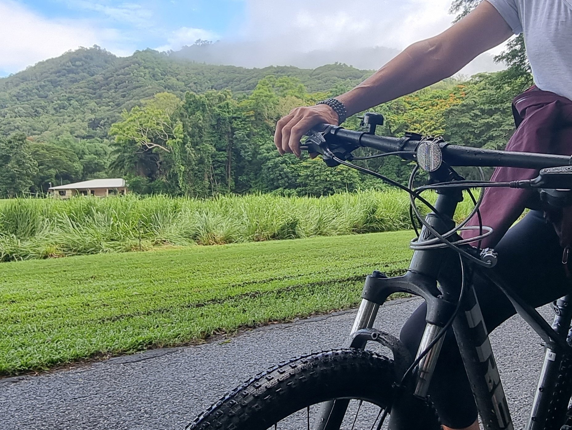
In the meantime, as we are relaxing into the tropical lifestyle that PD offers, we decided it was only fair that Bob had a bit of down time as well and so we purchased a couple of entry level mountain bikes. As well as exploring the town and environs, Ian decided we should try out a local MB track and we drove to the start of a short 8km loop which looked to be of moderate difficulty and had the advantage of taking us to Hartley Falls which promised no crocs and the opportunity for a swim.  Our first effort was cut short when Ian had a puncture after we had grunted/sweated three quarters of the way up a (very) steep hill and so had to abandon our plans and limp back to Bob.  The local bike shop replaced the tube and we set off a couple of days later with a spare tube and repair kit.  Unfortunately, the second effort was no more successful as we took Leroy along and he ran out of steam at the exact same spot of the puncture.  This resulted in one of us enjoying the downhill ride back to Bob and returning up the hill to rescue Leroy.  Our third attempt was a little more successful in that we managed to get past the bogey spot but after cycling further up the hill (we really were pretty high up by now) we realised we were in completely the wrong place.  Despite evidence to the contrary, Ian’s position in his capacity to co-pilot us around the world is secure as the only other candidate for the role is usually asleep in the back.

How is Leroy getting on?  As observers, we would have to say that he is loving his new life, he is healthier and fitter than ever before and gets to spend all his time with us which is what most dogs probably desire the most.  Of course there are pros and cons to travelling with a dog especially in a country such as Australia where all the National Parks are out of bounds.  There are also limitations when looking for places to camp or stay as accommodation that extends to pets is sometimes hard to find, although I think this is improving.  Yes, he takes up quite a bit of space, not excluding his personal possessions and the amount of food he insists on travelling with, he is often smelly and the amount of hair he sheds makes me think about knitting jumpers.  Despite all this, he adds a dynamic to our group that is truly valuable.  His demand for daily walks makes sure that we explore our surroundings in a way that I am not sure we would otherwise and helps us maintain our own fitness levels.  As mentioned before, he is a great conversation starter despite the fact that he won’t let many people touch him and is really quite anti-social.  And, not that we have run into any trouble, but there is no question that he provides a solid security service and does bring a sense of safety from time to time.  He has his own trampoline bed which has proved to be a great success and an ever increasing supply of balls which he seems to find everywhere we go.  He also has “Woolfie", a little brown stuffed something that is the only thing that has survived since he was 12 weeks old.  Most of all, he has an unwavering dedication to getting full enjoyment from every day, he never complains and is a source of constant amusement.

As we wait to progress on our way, we are working our way through PDs many bars, cafes and restaurants and have been contemplating our new lifestyle and changed circumstances.  We both agree that our decision to travel full time is the opportunity of a lifetime and, for the most part, we are smiling and laughing our way through the experience.  Of course, we have our off days but we are pretty compatible when it comes to ignoring each other and are both capable of switching off, a state of affairs that we are able to sustain for as long as is needed.  The tension usually eases when one is desperate to share something with the other or we start to laugh whilst in the middle of an argument which is annoying but effective. 

On reflection, we have been looking at our travels within Australia and agree that we have made so many memories in the last 6 months and seen rather more of this country that we initially intended.  Time has started to slow and there is a feeling of timeless anticipation stretching out in front of us.  Prior to selling up, most of our adult lives have been an exercise in routine and discipline and although these aspects are still important whilst on the road, they do not carry the same weight.  The relief in the shedding of responsibility that comes with owning a demanding property and the freedom that opens up by stepping away from the security of a familiar environment is truly liberating and neither of us have wanted anything we have supposedly given up which is both a little surprising and hugely encouraging.

From an objective point of view, we appear to be slowly returning to a version of our younger selves, as we are both able to glimpse the people we were when we first met and committed to continuing our lives together.  As you age together and deal with all that life throws at you it is easy to lose parts of yourself along the way.  Take it from me, these parts are not lost, maybe just buried a bit! 

We asked each other what part of this new life had provided the most enjoyment.  Ian was very quick to show me his feet which have thrived from many barefoot walks along the beach and are now tanned and almost unrecognizable.  Not something you probably think about much sitting in brogues in an air-con office for long periods of time, or maybe it is?!  For me?  Not picking up horse poo every single day in all weather - my back will be eternally grateful.

The Daintree Rainforest

southern cassowary (istockphoto)

The Daintree Rainforest is a lush, vibrant, green expanse, covering an area of 1,200 square kilometres which is roughly the same size as Sydney. It is estimated to be approximately 180 million years old (depending of where you are getting your information) and is without doubt the oldest tropical lowland rainforest in the world.  Successive climate changes over the last 200 million years have resulted in the contraction and expansion of rainforest within Australia and during dry ice ages many plants and animals were unable to adapt to changed conditions and were driven to extinction. However, the Daintree, with its cloudy wet mountaintops and deep moist valleys provided a refuge for many life forms during these periods of climatic fluctuations and is now home to evolved species of plants and animals, many of which have not changed very much from their ice-age ancestors. Around at a time when dinosaurs roamed the earth, there is certainly a jurassic aspect to this most beautiful part of Australia, a beauty acknowledged by David Attenborough in his acceptance speech of the 2017 Britain-Australia Society Awards, when he named his favourite place as North Queensland, not only because “it has an amazing rainforest which is quite unlike any other rainforest in the world”. The first episode of his 2019 series “Seven Worlds, One Planet, Australia” begins in the Daintree https://www.bbc.co.uk/programmes/p07v1xhh - who better to gain insight from?

young ribbonwood/idiot tree

During the first episode, the viewer is introduced to Big Bertha, the Grand Dame of Cassowaries and, as we headed into the rainforest, spotting one of these dino-birds - probably the bird most closely related to the dinosaurs - was right up there on our wish list. The Cassoway is the third largest bird in the world after the ostrich and emu but much more colourful with a bright blue head and vivid red double wattle (similar to the loose hanging neck skin of a turkey x 2). It also sports a striking casque (helmet-like structure) atop its head, reminiscent of many dinosaurs. Although by nature a shy bird, the Cassowary is considered to be the world’s most dangerous bird to humans.

fan fern

The Cassowary has huge value within this complex ecosystem. They are one of only a few fruit eaters that can disperse large rainforest fruits and the only one that can carry them over long distances. As such there are now programmes in place to protect dwindling numbers as they become more uncommon and hard to find. We were lucky enough to observe one of these strange birds as it crossed the road in front of us. Unfortunately, we were not quick enough with the camera so you will have to take our word for it.

The rainforest is home to an estimated 3,000 species of plants and there are more tree species in one hectare than in the entirety of the UK. The wonderful flora boasts myriad species of trees, ferns, climbers and epiphytes (plants that healthily live on other plants) and includes large fruiting trees, beautiful flowering orchids and fabulous fan ferns. One interesting tree goes by the name of the Idiot Tree, a Ribbonwood tree dating back 120 million years, one of the rarest and most primitive flowering plants in the world. It is believed that the colloquial name of Idiot Tree derives from its name of Idiospermum but coincidentally Idiot Tree is quite an appropriate name as it produces large brown fruit which is highly poisonous, one of the few fruits that no rainforest bird or animal can tolerate. Accordingly, the only way that the tree can propagate is through gravity which probably explains why it is so rare.

Similar to the plants in the Daintree, the area is also home to the greatest concentration of rare or threatened animal species in the world. These endemic species include the Cassowary, Boyd’s Forest Dragon and the Bennett Tree Kangaroo. During the few days we were there we spotted an Amethystine Python, many frogs, turtles, shrimps, stick insects, Katydids, spiders and butterflies, including the large stunning electric blue Ulysses Butterfly.  We also saw heaps of bats and lizards and, my favourite, dazzling firefly beetles.

katydid

We spent 10 days in the Daintreee and while there we enjoyed some longer and shorter walks, including some slow explorations of several of the boardwalks, including a guided tour after dark which was both informative and fun. The many beaches are never far away and are great to explore as there is rarely anyone else around, although you do need to keep an eye out for crocs as they are regularly seen away from their usual habitat of nearby river tributaries. 

We particularly enjoyed our walks before bed, when it was dark and devoid of traffic, with Leroy off the lead and just the calls of bats and the occasional bird and the night insects to break the silence. Because of the high tree canopy in the rainforest it really is pretty dark at night, which made the fireflies all the more spectacular. They range from the occasional flash to a full electrical display.  Quite magical.

Northern Queensland

four mile beach, port douglas, Qld

Finishing our drive across the Savannah Way, we rocked up at Port Douglas which is, without doubt, a tropical paradise and possibly our favourite town in Australia.  It is probably fair to say that after the arduous trip over from NT we could have arrived pretty much anywhere and it would have been right up there, but PD really ticked every box we could throw at it.  If Broome is where the desert meets the sea, PD is where the rainforest meets the reef.  What is so great about this small resort town all the way up the coast of northern Queensland?  Well, our timing couldn’t have been better as the average daily temperature was between 25-30C, a bit cloudy at times, but generally day after day of warm, balmy sunshine.  The famous Four Mile Beach, with its cerulean waters glistening like diamonds and rolling gently over the soft white sand extending around a bay fringed with palm trees and overlooked by the misty slopes of the rainforest clad ranges.  The town itself has a laid-back vibe but there is no denying that people here have got their act together.  That fantastic holiday feeling is felt almost the moment you arrive and the many restaurants, cafes and bars of Macrossan Street are modern and creative Much of the accommodation and eateries open up towards the sea front, a feature that was sadly missing in Broome, and the main street of shops provides most of what you might need during your stay.  There is little in the way of industrial estates or shopping centres either in, or on the outskirts of, town which adds to the charm.  The finishing touch for us was our stay at the Pink Flamingo.  Centrally placed, this relaxed resort consisted of 10 villas dotted around a communal swimming pool, bar and bbq garden.  Each villa was self-contained with its own kitchen and large tropical garden and use of the washing machines and bicycles was free of charge and they loved dogs!  This place was incredibly good value for money and run by a nomadic family from Yorkshire, UK.  Another credit to Port Douglas is the apparent lack of commercial greed that we have seen so much of in WA and NT where prices have been hiked up to ridiculous levels, taking advantage of trapped Australians who, because of Covid and restrictions implemented by the Australian government, have been unable to travel overseas and are exploring their own country instead.

PD has an interesting history that appears to have moved between boom and bust since the 1870s.  The port was first established in 1877 following the discovery of gold in the surrounding tablelands, and infrastructure followed in the form of Government offices, banks, a courthouse, lighthouse and hotels.  PD became the main port in the area during the peak of the gold rush and up until 1885 when the train link from the mineral rich tablelands took a new route directly to Cairns, bi-passing PD and resulting in the decline of further development.  This bypassing of PD led residents to turn to other forms of income and, with tick fever impacting cattle herds, many farmers turned their land into sugar producing plantations.  Once again the port became viable, with large quantities of sugar cane being shipped south for processing until 1897 when the opening of a cane crushing mill in Mossman (a small town 11 km north of PD) again stymied progress of the town.  A single gauge rail line was built from the mill to the under-utilised PD wharf in 1990 and transport of sugar, freight and passengers revived the town until 1911 when a massive cyclone stormed through bringing 16 inches of rain in 24 hours.  Many of the town's building were damaged beyond repair and by 1920 the business centre of PD had relocated to Mossman and its mill.  In 1933, the Cook Highway opened along the coast between Cairns and Mossman and with the opportunity to transport sugar by road directly to Cairns, the amount of produce transported through the PD wharf slowly decreased, until 1958 when it stopped altogether, leaving PD a sleepy fishing village.  Since the 1970s, construction of the new Cairns international airport, development of a 5-star resort and Barrier Reef tours, PD has become a popular destination for both Australian and international visitors.

sugar cane crops arouond mossman

We loved PD so much that we ended up staying for the best part of a month but we took some time out  to have a good look around.  It would be almost impossible to miss the thriving sugar production in this part of the country.  Sugar cane was introduced to Australia in 1788 on the ships of the First Fleet, but early plantings in parts of New South Wales were unsuccessful.  It wasn’t until the 1860s that a viable plantation and mill was established further north, not far from Brisbane.  By the 1880s cane crops were being developed further north along Queensland’s tropical coast.  There was a fundamental problem however, as the cost of employing Australian workers to work on the plantations was too expensive to compete with the overseas sugar producers such as Fiji, Indonesia and South Africa.  To overcome this, it is estimated that between 1863 and 1904 more than 60,000 Kanakas (a Hawaiian word meaning ‘man’) were shipped to Queensland to carry out the work.  Recruitment often involved forced removal of young men and boys, aged between 9 - 30 years, from more than 80 Pacific Islands, including Vanuatu (then called the ‘New Hebrides’), the Solomon Islands, and to a lesser extent, from New Caledonia, Papua New Guinea, Kiribati and Tuvalu.  While some islanders were willing volunteers, many workers were enticed onto the European ships, probably under the disguise of trading, as part of the practice of kidnapping labour known as ‘blackbirding’ (‘blackbird’ was another word for slave).  They were brought into the country illegally and older generations recall stories of ancestors being sold like cattle at the shipping docks in Queensland before being transported to the sugar plantations where they were often forced to work and live in poor conditions.  A law was passed in the late 1860s to regulate labour trafficking into Queensland by the establishment of an indentured (contract) labour system but Islanders continued to be exploited with meagre wages and unable to break the terms of contracts that they were obliged to enter into.  It is easy to assume that few of those signing labour contracts spoke English or would have understood how the system worked and what their obligations would be.  It is estimated that 30% of those brought to Australia died young, possibly due to a lack of immunity to many of the diseases common to the European community.  At the turn of the 20th century, in line with the White Australia policy, most remaining South Sea Islanders were deported – the only victims of mass deportation in Australian history. Those able to stay continued to suffer hardship and discrimination. 

the sugar train

The sugar plantations then saw a new breed of canecutter, young European migrants coming to Australia to “make their fortune" in the cane plantations.  Italians in particular provided much of the workforce and made a strong contribution to the growth of the Australian sugar industry into the mid 1950s.  During the 1950s the sugar industry boomed and mechanical cane harvesters were introduced so that by the late 1960s, more than 85% of the crops were harvested by machine reaching 100% mechanical harvesting in 1979.  Today, Australia is internationally recognised as one of the most efficient sugar producers in the world.  We didn’t go on one of the many sugar cane tours offered, but as we were there during cane cutting season we did see the single gauge locomotive pulling 33 giant carriages full of cut cane en-route to the Mossman mill for processing.  Approximately 95% of Australia’s sugar cane is grown in Queensland and 80 to 85% of Queensland’s raw sugar is exported.

In Australia everyone is familiar with the cane toad problem but for everyone else – the story starts in 1935 when 102 cane toads were introduced into northern Queensland from Hawaii.  They were imported by Sugar Research Australia in an attempt to control Australian native beetles which were damaging sugar cane crops.  They were intended as an alternative to pesticides such as arsenic, pitch and copper and by March 1937 around 62,000 toads were bred in captivity and then released.  Unfortunately, the hardy amphibians had little impact on the beetles they were expected to control as the beetles tended to live in the upper stalks of the cane plants and the toads were unable to jump that high (2 feet is thought to be their average range).  Instead, the voracious cane toads went after everything that they could catch including insects, bird’s eggs and native frogs, taking food sources away from native species.  They also had an alarming effect on any would be predators as their high toxicity levels proved fatal to snakes, goannas and freshwater crocs.  Since their release the toads have proved to be amazingly adaptable to Australian conditions and now number over 200 million and have spread into the Northern Territory and Western Australia and it is currently estimated that they are moving into new areas at the rate of 40-60 km per year.  They are adapting to dry, desert conditions as well as cold climates and are also starting to breed in salt water.  

There are many initiatives in place to try and eradicate these, now unwanted, toads including introduction of a viral/bacterial toad pest, toad musters, smearing with haemorrhoid cream which acts as an anaesthetic, spraying with Dettol, freezing or hitting them on the head with a flat hammer.  In true Aussie fashion, sports have developed such as cane toad golf, cane toad cricket, cane toad racing and the annual “Toad Day Out” in Townsville when prizes are awarded for the largest toad caught and the heaviest weight of toads caught.  Interestingly, one native species, the Torresian crow has learned how to kill and eat the toads without ingesting the poison, a quick flipping of the toad onto its back followed by a bill jab to the throat where the skin is thinner, thereby giving access to the toad’s non-toxic innards.

There is a great 47 min doco., Cane Toads: An Unnatural History which was released in 1988 scoring an impressive 88% on Rotten Tomatoes!

daintree river

Travelling away from PD, on the other side of Mossman, is the car ferry that crosses the Daintree River.  It is a quick 10 minute crossing that provides a good viewing platform to observe the basking crocs that lie on the river banks.  Driving off the ferry you are immediately surrounded by the Daintree Rainforest, one of the few unspoilt pockets of lowland rainforest left in the world and also the oldest, as it is thought to be around 130 million years old, very much the older sibling of the 55 million year old Amazon.  Covering an area that extends north from the Daintree River up to Cape Tribulation and west as far as the Great Dividing Range the Daintree is a narrow, 23km strip of tropical coastal lowland rainforest, two hour’s drive north of Cairns.  It is estimated that half of the rainforest has been cleared and much of what is left has been selectively logged.  What remains is exceptionally high in biodiversity and conservation value as it contains an almost complete record of the evolution of plant life on earth.  The Daintree is part of the Wet Tropics of Queensland covering an area that is less than 0.1% of the continent yet contains 40% of bird species, 35% of frogs, marsupials and reptiles and 65% of bat and butterfly species. 

The Daintree region was originally home to the indigenous people of the Kuku Yalanji tribe who were living in scattered camps along the creek and river banks when the Daintree River was discovered by Europeans in 1873.  It didn’t take long for gold and tin prospectors to arrive in the area along with timber cutters and dairy farmers and whilst businesses progressed on the southern side of the river the northern side proved much slower given its isolation, ruggedness and remoteness.  However, the region did contain valuable Red Cedar and regular transport across the river began in 1956 with a road built through the Daintree and up to Cape Tribulation in the 1960s for the purpose of timber transportation.  In 1983, local government moved to extend the existing road further north which triggered concerned locals to form the Wilderness Action Group with an intention to stop the road being built.  It was in December 1983 that the Daintree Blockage began, one of the biggest environmental protests in Australia at that time.  The Blockade came to a head in August 1984 as protestors chained themselves to posts, climbed trees marked for felling and buried each other in the path of the road building bulldozers.  The road did go ahead but the protests attracted a lot of media and public attention which resulted in far north Queensland’s Wet Tropics, including the Daintree, being added to the World Heritage register.

We were in the Daintree on 30th September 2021 when the news broke that an historic deal had been made whereby the land had formally been handed back to the custody of the Kuku Yalanji people, the result of a long battle with the Queensland government that started back in 2016.

throughfare - daintree rainforest

view from mt sorrow ridge

Leaving the ferry, the narrow bitumen road meanders through the thick, lush, green canopy of this staggeringly beautiful area.  Gravel side roads head off to the left and right leading to hidden residential and holiday accommodation.  If you didn’t stray off the main throughfare, you really wouldn’t see much infrastructure as the rainforest lines the road on both sides opening out only occasionally to allow access to a small café or fuel station.  There is no public cell reception which adds to the feeling of remoteness and outside of the car the sound of the many insects and birds is a constant accompaniment.  Many of the small local businesses were closed, probably due to the lack of international tourists as well as internal border closure with much of Australia and, whilst it is sad to see people struggling, it was an ideal time to visit without the crowds.  We were extremely fortunate to spend a week at Prema Shanti yoga and meditation retreat who not only opened their doors to us but also to Leroy, a new experience all round.  We also challenged ourselves on the Mt. Sorrow Ridge walk, which proved to live up to its name.  The track is beautiful as it climbs from the coastal lowlands of Cape Tribulation up through the rainforest-clad ridge to a metal viewing platform overlooking the beautiful Daintree coast.  It took us 4½ hours to complete the 7.5 km return trail which should give you some indication of difficulty – no we didn’t stop for a 2 hour lunch break.  It was so steep in parts that progress required a certain amount of rock scrambling, utilisation of narrow tree trunks to pull ourselves up and a conveniently placed rope to navigate a particularly tricky section.  It was well worth the effort and definitely recommended if you find yourself in the area.

Our stay in the area would not really be complete without a visit to the Great Barrier Reef.  We had visited some years ago when we stayed at Lizard Island, one of the more luxurious options from which to explore the Reef but with a view to protecting our financial assets as long as possible we opted for a snorkelling tour out of PD.    We chose ABC Charters, a small operator, rather than one of the “big boys” for our day out.  The advantages of a smaller outfit is they only take 12 people out at a time and provide 2 marine biologist snorkel guides who accompany the group for the entirety (2 hours) of time in the water.  Another good reason to go with these guys is that they have access to areas of the Reef that the big commercial boats are not permitted to go, so you end up seeing areas of pristine coral and associated marine life.  Just for comparison many of the larger operators, in a typical season, take two boats out to the reef per day each time carrying between 300-400 passengers.

It is difficult to get a good perspective of the entirety of the Reef as it is comprised of over 2,900 individual reefs and 900 islands, stretching for over 2,300 km over an area of roughly 345,000 square km.  It is the world’s largest coral reef system and the biggest single structure made by living organisms.  It was selected as a World Heritage site in 1981 and labelled as one of the seven natural wonders of the world in 1997.  

Our trip included two snorkel sites and at both of these the reef looked to be in great health with beautiful coloured coral, masses of fish, eels and giant clams.  However, a 2020 study has found that over half of the reef’s coral cover has been lost between 1995 and 2017 and that doesn’t take into account the effects of a widespread bleaching event that occurred in 2020.  Higher water temperatures, as a result of global climate change, are having a detrimental effect on the percentage of baby corals being born alongside many mature breeding corals dying.  The International Union for Conservation of Nature (IUCN) now has the Great Barrier Reef marked as “crtitical” so yet another of the world’s amazing offerings that you might want to bump up your list of places to visit.

Termite Mounds

Possibly not everyone’s chosen topic but here’s a little bit of information about termite mounds

Termites have colonised pretty well all land masses on earth, other than Antarctica.  However, termite mounds are only found in any numbers in Australia, Africa and South America.  There are 360 known species of termites in Australia, compared with over 3,000 worldwide.  They are eusocial insects (which means the highest and most successful level of organisation of any social insect colony).  Each species builds a nest, and if that nest protrudes above the ground it is called a termite mound.

As we drove up through Western Australia and then across the top of Australia through the Northern Territory and Queensland, Sarah and I were staggered at the vast number of termite mounds, which often dominate the landscape in all directions.  I can’t find any reliable estimate of the number that are out there in the Australian outback, but it must run to many millions.  A single termite mound can be home to a colony of as few as several hundred termites, but more often up to many millions.

Although some of the mounds we’ve seen in Australia are large, especially in the Northern Territory where the largest of Australia’s termite mounds exist, being up to 3m or more in height, the majority of the mounds we’ve seen to date have been relatively modest in size, maybe waist high on average. Compare this with some of the mounds in Africa, which has the largest mounds in the world, reaching up to 8 or 9 metres.  The tallest mound ever recorded was in the DRC (Democratic Republic of Congo), standing at 12.8 metres.

Anyway, seeing all these mounds around Australia I decided to do a little bit of research, and this is a small part of what I’ve found.

It is a telling statistic that although termites and ants make up only 1% of insect species, they account for 50% of all insect biomass.  In other words, there are a lot of them around!  A termite queen is the longest lived of any insect and can reportedly live for 30-50 years, although more normally 15 years, laying hundreds of millions of eggs during that period (one every three seconds, or 30,000 per day!).  As a little aside, in case anyone is interested, termites originally evolved from cockroaches, albeit a very long time ago (170 million years).

As for a typical termite mound, about one third of the mound is above ground, with the remaining two thirds below ground. The principal purpose of the mound is usually described in the literature as being to provide a protective environment for the termite colony and to regulate airflow, temperature and humidity.  Delving a bit deeper and it appears that there is also a complicated symbiotic relationship going on at the very heart of a termite mound.  Underneath the queen’s chamber is a ‘fungus garden’ which can occupy as much as 8 times the space occupied by the termites.  The termite mound contains long foraging tunnels into the surrounding area, through which some of the termites exit and then return with their intestines stuffed full of chewed grass or wood.  Arriving back at the mound they ‘defecate’ this chewed fibre.  Other workers in the colony gather this product and construct combs (think honeycomb), which are then seeded with fungus spores.  As these fungus spores sprout and grow they dissolve the tough fibrous cellulose mixture left by the termites (a bit like an external stomach for the termites) leaving a relatively high energy mixture for the termites to then feed upon.  Good for the fungus and good for the termites.  It has been estimated (by some professor who’s devoted his life to this subject) that the fungus accounts for 85% of the metabolism taking place inside a mound.

There are other interesting aspects of some of these termite nests.  For instance, in the Northern Territory many of the termite mounds are oriented towards magnetic north, so that the base of a 3m high mound might be 3m wide in the north-south direction and perhaps 1.5m in the east-west direction, providing more warmth in the morning and evening, and less exposure in the extreme heat of the midday sun.  On the Mary River, again in the Northern Territory, we observed a number of termite nests high up in trees on the banks of the river.  Each nest was connected to the ground by a long tunnel covering the outside of the tree trunk, the point apparently being that when the area floods during the rainy season, the nest will remain above the water level.  I guess when you’ve been around for millions of years you get the hang of what works and what doesn’t.  Who would have thought that termites could be so fascinating.

The Savannah Way

savannah way, nt

savannah way, nt

The Savannah Way is a 3,700 km route across the top of Australia, linking Broome in Western Australia with Cairns in Tropical North Queensland.  Like any long road trip, the adventure is partly to be found in the unscheduled stops, unexpected events that invariably arise, the people you meet and the special somethings that catch your eye.  There are route options you can take depending on your choice of 2WD or 4WD and this is our experience of the 4WD road less travelled.

We had already driven from Broome to Katherine and to complete the entire route would mean driving the remaining 2,100 km to the coast of Northern Queensland.  We never planned to drive this route but given the difficulties in leaving Australia and embarking on our world travels, we found ourselves with some time on our hands.  Our original idea of hanging around in Darwin until we were able to get across to Dili, Timor-Leste, was no longer something we wanted to do given the high muggy temperatures and expensive cost of living - visiting Queensland seemed like a good idea and so back to Katherine we went.

Katherine to Mataranka 108 km
Leaving Katherine on the Stuart Highway, the first stop was the small town of Mataranka which is popular for its thermal pools and springs which are located in the Elsey National Park.  The crystal- clear waters of the springs have a year-round temperature of 34°C and are a popular attraction.  Although there are crocs in much of the Park, the springs are considered a safe zone and it was a fun  way to spend an hour or so, just sitting on a noodle being taken gently downstream through a forest of pandanas palms.  The town is also made famous by the novel We of the Never Never, an autobiographical novel by Jeannie Gunn first published in 1908.  Although published as a novel, the book is an account of the author’s experiences as the first white woman to settle in the Mataranka area in 1902.  There has also been a film made of the same name, which was shot on location in the Northern Territory in 1982.  The town has a population of around 350, 30% of whom are Aboriginal and/or Torres Strait Islanders, the majority of whom appeared to be in the town park sitting around in small groups.  Walking between the groups you get a strong sense of community as everyone knows each other and there appears to be a genuine enjoyment in their spending time together.  There were a few camping options to choose from in town and we stayed at the Mataranka Springs Caravan Park which was within walking distance to the springs.   

limmen national park. nt

limmen national park. nt

Mataranka to Limmen NP (266 km)
Just south of Mataranka we joined the Roper Highway and continued along a single-lane ribbon of tar which took us through flat grassy savannah country dotted with small, dispersed trees.  Driving through such vast, empty spaces it is easy to daydream behind the wheel only to be jolted awake by the sudden appearance of a car hurtling towards you which necessitates both vehicles straddling the shoulder, with two wheels in the loose rubble at the edge of the bitumen, in order to pass each other.  Luckily we didn’t meet any road trains as they make no attempt to move over, making the encounter the most extreme form of road chicken with highly stacked odds against the little guy.  It wasn’t long before the tar finished and the now familiar red dirt track appeared and it was time to let the tyres down.  The dirt road had the usual corrugations and was a bit rocky in parts but was in pretty good condition.  The appearance of some hills enhanced the landscape and the drive was straightforward all the way to the almost non-existent town of Roper Bar.  If you blinked you would have missed it, there was a store with a couple of fuel pumps and I think that was about it.  We re-fuelled and got talking to the attendant who was interested in our efforts to get an Indonesian visa.  He had a staff member/cook (not sure who he was cooking for) who was stuck in Australia while his wife and child were at home in the Philippines.  He had been trying to get back to them for quite some time.  It is easy to forget how badly Covid has affected the lives of many people who are stuck in parts of the world that they really don’t belong nor wish to remain.  It was late afternoon when we camped just outside the entrance to Limmen Park.  It was a quiet spot and we only saw two vehicles, both with tinnies attached, heading into the park before it got dark.

Limmen NP to Boroloola (286 km)
Limmen Park is not so well known and, given its location which is pretty much in the middle of nowhere, not much visited.  Consequently, the Park is pristine and unspoilt and given that it crosses four major rivers, is a paradise for anglers and birdwatchers.  It was declared a NP in 2012 and sits on the edge of the Gulf Country in the east of the Northern Territory.   It is 9,369 km² with just one unsealed throughfare which runs north to south or south to north, which has several small tracks leading off it to a few designated campsites and boat ramps.  There are no services after Roper Bar until the small town of Boroloola, a distance of nearly 300 km.  Entering the Park mid-morning, we drove for about an hour and a half enjoying the diverse scenery of woodlands, rivers, floodplains and billabongs when a dull bang from Bob’s rear indicated a flat tyre.  We both looked at each other for a good 30 seconds before getting out to look at the damage.  There are flat tyres and then there are blowouts.  Ours was a complete blowout which was highly disappointing as we wouldn’t get to use the puncture repair kit that every 4WDriver on the road so far had advised us to buy.  So, there we were in about 38°C heat and about 200 km from any services.  It has to be said that we are both pretty hopeless really as it took a while to locate the jack and then a bit longer again to find the locking wheel nut key which had been well hidden from potential wheel thieves and us.  But life does have a way of surprising you – Ian was just trying to work out where best to place the jack when help arrived in the form of Rod who was on his way to meet a mate at one of the campsites further into the Park.  We must have looked a bit pathetic as he was out of his truck and rummaging for his own jack and pieces of wood (to lift the jack) before we had chance to accept his offer of help.  Within 10 minutes the spare tyre was on and we were mobile again.  Rod’s truck was the only vehicle that we saw on the road through the entire length of the Park.    

southern lost city, limmen national park, nt

southern lost city, limmen national park, nt

Feeling a little insecure continuing without a spare tyre, we carried on south through the Park with fingers crossed that the road wouldn’t deteriorate too much.  If Limmen were to be known for anything, it would be for a number of sandstone formations which are known as the Lost Cities.  We knew that the Northern Lost City was accessed via a tricky 4WD track and not wanting to push our luck with no spare, decided to visit the Southern Lost City which was much easier to get to from the main dirt road.  As we were driving towards the car park, the Lost City suddenly appeared on the left side of us, seemingly out of nowhere, and would have to be one of the more extraordinary sights we have seen.  The 1.4 billion-year old spectacular sandstone spires rose up above the trees almost sentinel like in appearance.  We took the marked walking trail from the car park that led us amongst these strange sandstone pillars and up onto a ridge which provided a good view of the surrounding area as well as the Northern Lost City off in the distance.

We made camp just inside the perimeter of the Park and left the following morning heading to Boroloola, where we hoped to find a replacement tyre.  The tarmac reappeared  about 40 km before Boroloola and we both gave a sigh of relief as I’m not sure what we would have done if another tyre had failed.  Boroloola, pop. 950 (mostly indigenous) is a former frontier town and a small community just 50 km upstream from the sea.  It is 970 km from Darwin and 380 km from the Stuart Highway which makes it as isolated as any township in the Northern Territory can be.  Interestingly, the town is positioned in what could turn out to be one of the richest mineral provinces in the world with large zinc-lead-silver and diamond deposits being developed.  Re-fuelling at the friendly store/service station we couldn’t help but notice that the walls were completely covered with Baramundi fishing photos and this theme continued throughout the town, so no guessing how everyone spent their time.  What we hadn’t realised as we drove in was the fact that it was a Sunday and the one place that looked like it might be able to supply a suitable tyre was closed.  Not too concerned, we checked into the caravan park and took the opportunity to get some laundry done and have a shower.  Passing the time of day with other travellers who were staying in Boroloola, it was amusing to find that everyone was in some state of disrepair.  One chap was waiting for replacement parts to arrive to fix damage caused by a broken bearing on his trailer whilst another unfortunate guy had hit a pig, which had taken the front of his car off and then, he had driven into a pile of loose rubble and rock at the side of the road which had destroyed two tyres and to cap his day off he had spilt boiling water down both of his legs.  As everyone was travelling in the opposite direction to us we assumed that the road was about to get a whole lot worse.

 Bob runs on Goodrich mud-terrain tyres and there was no option to get one of these but we were really grateful to purchase a tyre that would “do” and were able to get it fitted the following morning.  Stocking up with some very expensive food supplies we rolled out of town just after midday.

Boroloola to Calvert River Crossing (190 km)

robinson river crossing

robinson river crossing

5 km out of town and we were back on an unsealed road driving through woodland, a lot of which had been burnt off and so was sparse and charred.  The road was so badly corrugated in parts that we couldn’t hear each other speak, add to that the large sections of bulldust and this was a challenging drive.  Once past the burnt sections the scenery was quite beautiful and there were a few river crossings that always make us laugh.  We spent the night above the Calvert River Crossing where Leroy and I had a splash-around in the water while Ian kept an eye out for crocs.  Walking back to our campsite we saw a golden tree snake in one of the small pools, he had his head out of the water a bit like a periscope and was watching us as much as we were watching him.  There were a few kangaroos around but the most memorable wildlife was the whistling kites which were circling overhead.  There would have been between 50 to 100 of these large birds of prey who, at times, were only 5-10 metres above us.  An amazing experience. 

Calvert River Crossing to Burketown (343 km)
Crossing the Calvert River the next day the road condition continued to be ok in parts but still presented some bone-rattling corrugations and big sections of bulldust.  There is a lot of discussion between 4WDrivers regarding the best speed at which to tackle corrugations, with strong advocates for travelling fast enough to skip from top to top of the ridges giving a much smoother ride.  However, this means that your wheels are not actually touching the ground for a portion of time resulting in less traction and causing the vehicle to behave very differently when braking, accelerating and cornering.  We belong firmly in the go slower group, and taking into account the alternating sections of rigid corrugations and bulldust we averaged a speed of 63 kmh (this information is provided by Ian who is tracking our journey with Gaia).  We gave up trying to have any sort of conversation as, like the day before, it was just too noisy and so we drove in contemplative silence for 112 km to the NT/QLD border.  Totally unpremeditated and similar to our crossing from WA to NT, we happened to cross the border on what would have to be the least used road possible.  A lot of travellers we have met have been concerned about getting stuck in a particular state or not being able to enter another state and were employing a number of tactics to ensure their onward travel.  Some were deliberately not signing in with the phone apps and so leaving no trace of having been in a particular area, while others were collecting all their invoices to prove that they had been in a particular area.  We seem to have a foot in both camps as I never sign in anywhere and just wave my phone vaguely at the QR code, while Ian announces his presence everywhere we go.  Should the Covid situation flare up in Queensland we now have a good idea of which roads are unlikely to have any form of border control enabling us to get back into the Northern Territory.

Robinson River, Savannah Highway, NT.jpeg

50 km past the border we arrived at what must be one of the best roadhouses in outback Australia, Hells Gate in Nicholson, Qld.  After all the red dust and kilometre after kilometre of emptiness, this well-kept green oasis sat in the middle of nowhere.  Offering accommodation, camping, a mini store, restaurant, bar and of course fuel, it was exactly how you would imagine an idealised roadhouse to be, right down to the friendly staff and various characters catching up over a drink.  There was also an airstrip just adjacent to the roadhouse sporting a couple of flashy helicopters and we spoke briefly to one of the pilots who was working for Geotech doing aerial surveys for mining companies.  Deciding this was a good opportunity for a break we stayed for a couple of hours and passed the time with Mike, a Queenslander who had been working for ALPA, the Arnhem Land Progress Aboriginal Corporation.  Established in 1972, ALPA began as a co-operative of community stores in several Arnhem Land communities and is an Aboriginal-owned organisation which aims to improve the health and nutrition of its members.  It also runs benevolent programs using the surplus funds generated from store operations.  Mike was extremely knowledgeable about some of the lesser visited parts of northern Australia and gave us a lot of ideas for the areas north of Cairns once we reached the end of the Savannah Way.

Dragging ourselves away from the roadhouse, we hit the road again and drove the remaining 178 km to Burketown.  Proudly pronouncing itself to be ‘The Barramundi Capital of Australia’ this town, pop. 238, had a school, a pub, a couple of service stations, a council office and a general store.  It was quite late when we arrived and stopping only to pick up some beer and wine from the pub we left town and camped about 5 km away in amongst some eucalypt trees and hidden from the road.

Burketown to Croydon (370 km)
Burketown has a long and interesting history and is named in honour of explorer Robert O’Hara Burke who died soon after making the first successful south-north crossing of the Australian continent in 1860-1861.  The Burke and Wills Expedition set off from Melbourne and consisted of six Irishmen, five Englishnen, three Afghan and one Indian camel drivers, three Germans and an American.  They took 23 horses, 6 wagons and 26 camels.   Not far from Burketown is a monument commemorating campsite 119 which was their most northerly campsite during the expedition.  Although the crossing was successful and the Gulf was reached only one Irishman made it all the way there and back to Melbourne. 

Krys, Normanton, NT.jpg

225 km from Burketown we stopped briefly at Normanton.  Primarily a cattle town, pop. 1,257 (60% indigenous), the town has a number of historic buildings and a feel of yesteryear.   It is also home to Krys – The Savannah King, a lifesize model of the largest croc ever shot and justifiably listed in the Guinness Book of Records.  Fifty years ago, this enormous 8.6 m croc was shot by a professional crocodile hunter, a Polish woman named Krystyna Pawlowski.  The only known photo of the famous croc appears to be a bit of an optical illusion – if you look closely, Krystyna and her husband Ron are kneeling down and are probably further away from the croc than you might first think.  It is estimated that the Pawlowski’s shot and killed 10,000 crocs before finding a conscience and building the country’s first experimental crocodile farm.  In 1972 Ron was invited to talk on the subject of Wildlife Conservation in the House of Representatives and was able to show that in just over twenty years the croc population had declined by 98%.  His recommendation to put a total ban on croc hunting was approved.  It is easy to be sceptical about the real size of Krys but a good story regardless.

 Since leaving Katherine, the daily temperature had been a consistent 36-39°C and time spent outside of Bob’s air con was uncomfortably hot.  We just couldn’t believe our luck when, 4 km outside Croydon, we saw a sign for Bellmore Lake that clearly showed the lake was safe for swimming.  Not wasting any time we followed the signs and arrived at what turned out to be the largest body of fresh water in the region.  Originally built to provide water for the town, the water behind the dam wall was available for a variety of water sports.  There were also showers, BBQs and picnic areas.  I don’t think a dip in a lake had ever felt so good.   Unfortunately, camping by the lake was prohibited and we ended up spending the night off a side road on the other side of Croydon.

Croydon to Mount Surprise (240 km)
The next town we came to was Georgetown, pop 348.  This was by far the nicest town that we had visited for some time and we parked close to the park and spent a couple of hours under the trees playing with Leroy and doing yoga.  Over a coffee at the friendly local café we learnt that their annual Rodeo was taking place in a couple of days time and they were expecting it to be a good weekend.  We would have been tempted to stay for the fun if it hadn’t been so damn hot.  The area around Georgetown has been mined for gold since the early 1870s but is now probably more famous for its rich gemstone deposits which include topaz, quartz, garnet, aquamarine and sapphires.  We visited the Ted Elliott mineral collection, housed in the visitor centre in the middle of town.  This private collection of gems, minerals and crystals, gathered together by one man over a lifetime of passion, showcases over 4,500 specimens including fossils, local history and mining memorabilia.  It was an impressive collection with the star of the show a 253 kg quartz crystal.   The remainder of the day was spent in the pub catching up on some admin before looking for a suitable place to camp.  We ended up on what seemed to be a private cattle station, although no-one was around apart from the cows.

atherton tablelands

atherton tablelands

Mount Surprise to Yungaburra (221 km)
Mount Surprise is a tiny tidy town that we drove through on our way to the Undara Lava Tubes.  Geologists estimate that around 190,000 years ago this region of north Queensland was dotted with active volcanoes.  The Lava Tubes were formed when 23 cubic kilometres of lava spilled out from a single volcano and travelled along a river bed.  The outer layer of lava formed a crust protecting still-molten lava which continued to flow creating a long tunnel-like tube.  It is believed that the entire length of the lava tube (160 km) is the longest lava flow from any single volcano on earth and would have taken 2-3 weeks with the lava flowing at a rate of around 500 metres per hour.  We were keen to take a tour into the Tubes but when we arrived at Undara Lodge to make enquiries we had just missed one tour and the next was not departing for a couple of hours.  Not wanting to wait we drove to the Kalkani crater carpark and did the short 2.5 km walk around the rim of the crater.  The views of the surrounding countryside were good and we could see the darker pockets of rainforest growing on top of the tubes which clearly showed where the lava had originally flowed.

Millaa Millaa Falls, atherton tablelands, NT

Millaa Millaa Falls, atherton tablelands, NT

Rainforest did you say?  Yes, leaving Undara we were only 260 km from Cairns and patches of rainforest were now part of the landscape.  The temperature had dropped to a comfortable low 30°C and the countryside was greening up.  Our destination for the night was Yungaburra, a small town on the Atherton Tablelands which are part of the Great Dividing Range.  The tableland is highly fertile due to all the volcanic activity over the years and the range of crops grown is extensive including avocados, bananas, cashews, citrus and coffee to name just a few.  The dairy industry is also significant and the green rolling hills that we were now driving through was a welcome change to the red, dry landscapes that we had seen for the majority of the Savannah Way.  We loved this area and ended up staying for three nights at the On The Wallabee Lodge which was right up there for so many reasons.  The lodge had been set up to provide a base for all travellers and welcomed dogs with open arms which was a bit of a first.  Offering shared dorms, container rooms and on and off-site parking for people preferring to sleep in their vehicles, an open-plan kitchen leading to numerous relaxation areas including a garden with hammocks, fire pit and a covered Mediterranean style long table and chairs, this place had everything.  Everyone working and staying there had an inclusive attitude and it was a real home from home.  There is so much to see and do in the tablelands as the area has some great hiking, bike tracks, stunning waterfalls, crater lakes and plenty of foody options at the dairies, plantations and cute towns throughout the region. 

Our journey ended in Port Douglas rather than Cairns, 12 days after leaving Katherine The Savannah Way is passable to all vehicles including caravans during the dry season, generally late April to early October and depending on which route you take.  During the stormy season between October to January it is also navigable but advisable to take a 4WD or high clearance vehicle.  The Gulf Savannah Tourist Organisation offers advice on road conditions as torrential rain often results in roads being closed for days at a time.  If you are thinking of making the trip between January and March? – Good luck!

Northern Territory

Buntine highway

Buntine highway

Termite Mounds.jpg

Crossing into the Northern Territory we didn’t know what to expect other than it was going to be a bit on the warm side.  First impressions ……  It was hot, 35°C, with a lack of air movement that felt slightly claustrophobic and the closeness of the air required some effort to take a good breath.  An early break had been forecast with the wet weather expected during September rather than the usual late October/November which probably explained the feeling that everything was holding its breath waiting for the rains to come.  The dry, flat, treeless landscape stretched out as far as the eye could see in every direction, interrupted only by the termite mounds which when clustered together looked just like miniature cemeteries.  Such a different environment to the dramatic ranging landscape of the Kimberley.

Australia has many climate classifications, the NT having zones of equatorial savanna, tropical savanna, hot grassland (broken up into persistently dry/winter drought) and hot desert (again persistently dry or winter drought).  We crossed the border into the Territory via the Buntine Highway, which travelled through vast areas of hot grassland (winter drought).  Calling this road a highway was a bit of a stretch as the road alternated between a single lane, narrow strip of tatty edged bitumen sat atop red rubble or a six-lane-wide surface of unsealed, flattened, red rubble.  It is not often these days that you have to drive off the road to accommodate a vehicle coming the other way but this turned out to be a regular occurrence as we continued through NT, although hardly a nuisance as, on average, we were probably seeing only half a dozen vehicles a day.  The dry, savannah plains felt very empty apart from the odd herd of cows and the only place we passed through between the border and Katherine (over 800km) was the community of Daguragu, pop. 242, 96% indigenous, where there was a general store and a couple of fuel pumps.  100km out of Katherine we hit the National Highway and cruised into town listening to Bryce Courtney’s Tommo & Hawk, a diversion not possible on the dirt roads as Bob is pretty noisy as he rattles along. 

Katherine is a reasonable sized town with a good supply of essential shops and services.  We were surprised to see big banners everywhere advertising the sale of fireworks.  Apparently, NT celebrates Territory Day, the day independence from the Commonwealth Government was declared in 1978, with this one night of the year when you can legally possess and let off fireworks.  Locally known as Cracker Night it is loved by many for its atmosphere of unruliness and abhorred by others.  How quickly we accept new rules, laws and regulations.  It was a given growing up in the UK, that come Guy Forks night we would apple bob, eat toffee apples, run round with sparklers and watch the firework display set off by the grown-ups in the back garden.  Wind on a couple of decades and we are no longer responsible enough to behave in such a dangerous fashion – good on you NT!

 Since leaving South Australia water had been in short supply in most places, even to the point of struggling at times to fill Bob’s tanks.  Roadhouses would have their shower rooms locked and taps would have the push heads that you can’t fix a hose to.  You soon get used to conserving your water supply and it was a big contrast to suddenly have water in excess, even at the end of the dry season.  Public parks and general use areas were irrigated, green and lush and the caravan parks were happy to accommodate people washing their cars, vans and trailers – this was something we had definitely not come across previously.  Despite the irrigation, the dust was just as bad as we were accustomed to as any moisture was soon sucked up in the searing heat. 

Ever since entering the Territory we had commented on the constant burning-off that was either taking place, or had recently been carried out, along the roadside.  It was so excessive that finding an uncharred campsite was challenging and we did stop one night in an area that had been burnt through earlier in the year, leaving the following morning with everything covered in a fine black smelly film of dust.   That was a lesson well learnt and such a stop has been added to our ever-growing list of places we choose not to spend the night.  Others include, not being too close to the croc infested rivers and waterways as we struggle to keep Leroy out of the water and it seems unfair to keep him tied up the whole time.  Not camping where other people have obviously camped (unless there is a drop toilet close by) as Leroy has displayed quite a talent for finding, digging up and eating number twos.  These camp sites are also the worse for flies which is a shame as they are usually in the best spots.  Shade is now a priority as the sun is hot as soon as it peeps over the horizon and doesn’t set until just before 7pm and we do try to find somewhere that has some ground cover to alleviate the dust but this was rarely achieved.  

It didn’t take us long to realise that you can only purchase alcohol between 12 midday and 6pm and you must show ID.  Being asked for ID prompted a flashback to under-age attempts to acquire booze from the local off-licence and in that moment we felt like we were teenagers again and kidded ourselves that we must be looking pretty damn good for our age, but this bubble was soon burst when we checked into the caravan park and were asked if we had a seniors card??!!!

edith falls, nitmiluk np

edith falls, nitmiluk np

Most people are based in Katherine to explore the Nitmiluk NP, a huge area which includes thirteen impressive gorges carved from the ancient sandstone country.  The gorges can be explored by scenic flights, river cruises, canoes or on foot and there are many swimming holes to cool off in that are croc free.  There are also some rock art sites and accommodation ranging from campgrounds to luxury lodges.  Leaving Leroy in doggy day care, we spent a day at Edith Falls, a series of cascading waterfalls and pools within the NP.   Despite the heat, we hiked the 9km walking trail to the upper waterfalls and en-route, ran into a group camping at the base of the falls.  The location was absolutely stunning and at first glance looked about as close to paradise as you could get.  However, on closer inspection, most of the group were badly sunburnt and desperately trying to keep the hordes of flies off their exposed, sore skin.  One young guy was seemingly wearing every item of clothing he had with him, including a hat with a fly mask that tied off around his neck, in an attempt to conceal every inch of himself from attack and was sitting slumped with his chin resting on his chest looking hot, tired and miserable.  On top of that, the entire camp smelled like a latrine.   There is no doubt, that as beautiful as Australia is it can be challenging to get out there and enjoy it.

Before leaving Katherine, we attended the “must do” highlight - Marksies Bush Camp Tucker.  This guy has been going for over 20 years and presents an evening of stories around his life and experiences in the area whilst cooking bushman’s stew with native herbs and spices in 100-year-old cast iron pots.  It was certainly different and definitely the best damper I have ever tasted.

Travelling directly north, Darwin is the end of the line and we arrived with a long job list.  The car was booked in for a service, we needed to get the water tank re-welded, both wing mirrors were loose and would only stay pointing at the road directly underneath them, the windscreen was smashed again, there was post to pick up which had been sent to a Darwin suburb instead of Broome (a little odd), and we were hoping to start our visa applications for Indonesia and Timor.

We stayed in Darwin for 5 nights and, amazingly, managed to get most things ticked off our job list.  Darwin is a laid-back place and a foodie paradise.  The quality of fresh food and choice of great cafes and restaurants is the best we had seen since leaving SA.  The smallish population of around 140,000 makes it really easy to get around and nothing is too far away.  However, it is expensive and the hot humid climate is not conducive to being particularly active during the day.  Staying within walking distance of the harbour, CBD, Mindil markets and the casino we did enjoy the balmy evenings and the laid-back energy that this City offers. 

The one job we were unable to make any progress with was the visa applications.  Having spoken recently with the Timor-Leste Consulate and also a visa agent in Jakarta, we had been told that the best chance of getting entry into both of these countries was to apply for a business visa.  This is quite straightforward with the exception that T-L will require sight of a return or onward ticket.  As we will not be returning to Australia but crossing the land border between T-L and Indonesia, we need to have our Indonesian visa issued before we can apply for the T-L visa.  Unfortunately, the B211 business visa, which Indonesia has up until a few months ago been issuing offshore, is temporarily unavailable while the country attempts to bring Covid case numbers down.  As things stand, the issue of this particular visa is being reviewed on a weekly basis and we have to wait for the window to open again.  We had thought to hang around in Darwin until such time as we are able to proceed, but not knowing how long we would have to wait and given the increasing temperatures and humidity, we decided to head over to the east coast of Queensland, via Kakadu NP and the Savannah Way, eventually looping back around to Darwin once we are able to leave Australia.

Crocodillus Park Darwin, NT.jpg

A highlight of Darwin was the Crocadilus Cove which is home to the largest salties in Australian captivity.  There were half a dozen of these fearsome reptiles between 5-6 metres long, along with a collection of snakes and lizards that was truly impressive.  One of the crocs in residence was Bert, well known for his starring role in Crocodile Dundee as well as various TV and documentary appearances.  He was thought to be between 75-100 years old and was a particularly grumpy individual.  Several attempts to introduce a mating female had failed, resulting in a tragically gruesome end for the prospective suitors. 

wildlife tours.com

wildlife tours.com

There is something quite captivating about these lethal, prehistoric, creatures and keen to see more, en-route to Kakadu NP, I joined an Adelaide River cruise which promised to get up close and show wild crocs in their natural habitat jumping out of the water in order to reach the pig bits held on a rope about 2 metres above their heads.  Boarding the boat, I wasn’t really expecting to see much, but over the next hour as we meandered along, our indigenous skipper had 5 crocs propelling themselves vertically up through the surface of the river almost touching the sides of the open boat.  There is no doubt in my mind at all, that had I straightened my arm out sideways I would have been able to stroke the croc’s belly which given that this soft leather goes for about $80 a square centimetre, would probably have felt quite nice!  When telling us the market value of the leather the guide did add “in Europe” on the end of the sentence and repeated it again later on in the cruise.  I could only assume a vision of an exotic European civilisation all touting the very latest in croc wear, presuming of course that LV accessories hadn’t got there first.

I enjoyed being on the river so much that the following day we both went on a sunset cruise, this time along the Mary River.  Both the Adelaide and Mary Rivers are part of the thriving microcosm of Top End wetlands providing a rich habitat for wildlife, birds and fish.  Wetlands comprising swamps, marshes, billabongs, lakes, saltmarshes, mudflats and mangroves, with still, flowing, fresh or salt water are a valuable part of the environment.  They provide protection from the effects of extreme weather events such as coastal storm surges and floods, store carbon thus helping to reduce greenhouse gas emissions and remove sediment and nutrients from water systems.  Australia was one of the first nations to become a Contracting Party to the Ramsar Convention – an international treaty which was adopted in the Iranian city of Ramsar in 1971, aimed at halting and, where possible, reversing, the worldwide loss of wetlands.  There are now more than 170 Contracting Parties to the Convention with more than 2,300 designated wetland sites throughout the world, 66 of which are within Australia.

jabiru

jabiru

As we cruised along the river it was evident we were within a thriving ecosystem.  You definitely get the sense of a healthy environment for the birds (289 species), freshwater fish (55 species), snakes (39), lizards (76), bats (28) and mammals such as rats, platypus, wallabies wallaroos and dingoes. The birdlife was the easiest to observe and we were fascinated with the activity of it all.  We witnessed the giant jabaru/black-necked stork, as tall as 1.53m, patrolling the banks in a manner similar to a bobby on his beat, each red, long, stick-like leg being carefully picked up until almost horizontal with the ground before being placed slowly and carefully back down a long stride-width away.   At the other end of the scale the small jacana/lily hoppers were doing exactly what their name would suggest.  Some of the largest Barramundi in the NT have been fished out of the Mary River, often around the 25kg mark and we were a bit surprised to only see one tinny out fishing for the duration of the cruise.

jakana

jakana

The Mary River wetlands are home to the world’s largest concentration of salties and we did get close to about half a dozen of them.  Their main preoccupation seems to be fighting amongst themselves and many carry battle wounds and are often missing a foot or limb, with one unfortunate individual who had been bashed by a boat a few years ago which broke several ribs, left with lungs now inflating on the outside of his body.  An ability to survive is obvious given their 200 million years on this earth, aided perhaps by a couple of useful techniques.  They can lower their heart rate to 2-3 bpm, no doubt useful when stemming the flow of blood from an otherwise fatal injury.  They can stay underwater for around 1 hour and even in shallow water there is not a single ripple on the surface.  They have a strong instinct for the routines of others.  You might be able to fill your washing up bowl from the water once, maybe twice, but you would be foolish to attempt it from the same spot more often.  The croc can pick up on vibrations in the water over 1 km away and can swim at 24-29 kmh.  Final bit of interesting info.  They are attracted to bright colours, so if you do happen to be in the water with a group of friends, stay close to the one in the bright bikini.

Ubirr ancient rock art
ubirr lookout, shot for australia travel questions

ubirr lookout, shot for australia travel questions

Kakadu NP covers an area of nearly 20,000 km², extending nearly 200 km from north to south and over 100 km from east to west.  It is the size of Wales and nearly half the size of Switzerland.  It is one of Australia’s most famous tourist attractions and is on the UNESCO World Heritage list for both its spectacular environment and its cultural importance.  Since the late 1970s Kakadu’s traditional owners have leased their land to the federal body of Parks Australia with the intention of mixing traditional ways and modern science in joint management of the NP.  Unfortunately, this arrangement does not seem to have worked very well and bureaucratic mismanagement of the park has resulted in degradation to many of the sites.  The situation is so bad that Parks Australia is currently being prosecuted by NT Aboriginal Areas Protection Authority over alleged sacred site offences and at least one popular tourist site has been closed pending resolution and there is a concern that other sites such as Ubirr Rock Art may also close to tourists.   We visited Ubirr and after walking amongst the rock-painted ancient drawings we climbed up to the Ubirr Rock  lookout.  The view from the top takes in the Nadab floodplain as it gives way to Arnhenland and was absolutely breathtaking.  It was a wonderful experience to connect with such natural splendour and the thought that such areas could be closed off is sobering.  We feel so grateful to be able to visit these amazing parts of the world while they are still accessible and the magic held in the ancient landscape of Kakadu is something never to be forgotten. 

The Savannah Way in its entirety stretches 3,700 km across the top of Australia from Broome to Cairns (or vice versa).  Having already done the Broome to Katherine section – albeit in a roundabout kind of way – we thought it fitting to drive the Katherine to Cairns section (2,000 km) before we leave Oz.  There are a couple of road options, a 2WD bitumen road all the way or a 4WD lesser travelled route with unsealed roads, few town style facilities and isolated camping spots.  As with the Gibb River Road, this track is periodically closed and with the weather about to change from dry to wet we wasted no time in heading east.  Both routes initially go through the small community of Mataranka which is well-known for its hot springs which are a constant 34°C all year round.  The 4WD route then passes through Ropers Bar, the Limmen National Park, Boroloola, Hells Gate, Normanton, Croydon, Georgetown and Yungaburra before eventually reaching the Coral Sea and northern Queensland.

WA - The Kimberley

the amazing kimberley

the amazing kimberley

The Kimberley is the northernmost of the nine regions of Western Australia and the last area for us to explore before crossing over to the Northern Territory.  With the Indian Ocean to the west, the Timor Sea to the north and Great Sandy and Tanami deserts to the south and east, this is an area of rugged beauty and remoteness.  It is three times the size of England, almost as big as California and, with a population of less than 40,000 - an average of one person per 12.5km square - one of the more sparsely populated regions on earth. 

The first European contact in the region was made from the coast in the mid 1600s, but it wasn’t until the early 1800s that the coastline was mapped with any degree of accuracy.  This was followed by land-based exploratory expeditions that eventually opened up this vast, remote region.  European sheep farmers were amongst the first to attempt white settlement in the mid 1800s but were mostly unsuccessful due to the challenges of climate, distance, the harsh nature of the land and hostilities with indigenous inhabitants.  Although sheep farming was struggling, a favourable report on pastoral potential of the land for cattle, as well as the abundance of cheap, or free, labour to be found among the local indigenous people, was made by WA Government Surveyor Alexander Forrest in 1879.  He then went on to appoint himself land agent and leased out over 50 million acres of terra nullius to eager cattle ranchers from other parts of Australia.  Over the next few years he was strongly criticised for his dual roles as both an entrepreneur and an elected official with accusations of favouritism, corruption, bribery and nepotism, particularly as Government surveyors were not supposed to benefit from their work.  If you thought the surname was familiar, yes, he is the great-great-uncle of Andrew “Twiggy” Forrest who today owns more than 1.5 million hectares of WA. 

Recognition of this good pastoral land and the enthusiastic uptake of the leases led to a couple of notable drives by ranchers from the eastern states.  Durack left Queensland in 1885, eventually arriving in the Kimberley two years and two months later with 4,000 out of the original 8,000 cattle surviving the 4,500km.  The MacDonalds left New South Wales in 1883, a journey of nearly 6,000 km, arriving in the Kimberley more than three years later with 327 cattle out of the original 700.  These families were some of the original pastoral pioneers.

When pastoralism was first introduced to the Kimberley, indigenous inhabitants already living on the, now allocated, land often had to leave to make room for the white settlers or remain as station workers.  This was not an easy transition and what followed over the next 40 or so years were a number of noted massacres of the Indigenous population.  The original inhabitants on this land fought against the encroachments of the white settler who retaliated disproportionately, often burning bodies to conceal the evidence.  Incoming pastoralists often already had a history of violence in protecting their claimed properties, supported, no doubt, by articles such as the one written by the editor of the Northern Territory Times (18 Aug 1888) who wrote that police in the Kimberley should disregard any laws and “simply admonish them and disperse of them in the Queensland fashion” i.e. kill them.  “It is the only way to make the natives respect the lives and property of white men.” 

A compelling read is ‘Every Mother’s Son is Guilty’: Policing the Kimberley Frontier of Western Australia 1881`-1905 by Chris Owen.

Jandamarra’s War is a 2011 Australian drama style documentary that tells the story of Jandamarra, a famous Aboriginal Australian warrior and his years of conflict in the Kimberley.

The ability to stay on their country and care for their land and cultural sites and to pass on cultural knowledge to the next generation was, and still is, very important to indigenous people and many remained despite poor working conditions and maltreatment.

Huge cattle stations were steadily established and the need to get cattle to port for live export necessitated two unsealed tracks, one linking to the port of Derby in the west, the other to the port of Wyndham/Kalumburu in the east.  These tracks were hand hewn roadways, wide enough for bullock wagons and drovers with their cattle herds, and essential connections for the outlying stations to get their cattle to the ships for live export to Asia.  These two tracks are now superseded by the infamous Gibb River Road which was constructed in the 1960s as part of the Government funded initiative the “Beef Roads Programme”.  This 660km track only partially follows the original tracks, making its way right through the wild heart of the Kimberley.  It is constructed of dirt and gravel corrugated roads with multiple water crossings.  Continual upgrades are ongoing as the tourism industry grows and although not the wild ride it once was there are still plenty of opportunities for mishap and a 4WD vehicle with high clearance is essential.  Travel along the Gibb River Road is only accessible during the dry season which usually runs between March and October.  There is one alternative route through the Kimberley, a sealed, straightforward drive along the National Highway of just over 1,000km.

GRR

GRR

The attraction of making this iconic Australian 4WD journey, apart from the kudos of being able to purchase an “I did the Gibb” muscle tee, is the plethora of natural wonders that can be accessed along the deeply corrugated and pot-holed side roads and the opportunity to stay at one of the many million-acre cattle stations that are now cashing in on this bucket list adventure.

We were keen to experience the Gibb despite negative commentary regarding travelling this route with a dog.  We knew that most of the highlights were to be found in the various National Parks which was going to be a bit tricky and many of the stations did not welcome dogs.  Despite this, we felt the trip was still worth embarking on and were optimistic we would have fun regardless.

windjana gorge

windjana gorge

Broome is the gateway town to the Kimberley region but Derby, a small town 250km further north, is the last chance to stock up before heading out along the first 100km of straight, sealed road.  The sky is as big and brilliantly blue as we have come to expect and the landscape is greener than we have seen so far, despite the region being more than half-way through the dry season.  The Napier Ranges can be seen as a backdrop, superimposed to the point that they almost don’t look real.   None of the cattle stations along this initial section offered accommodation for dogs and so our first night was at a free camp spot alongside the Lennard River, where we spent the afternoon swimming and planning our tactics for the following day.  Leaving camp early next morning, we drove 24km down a side-track to Windjana NP where we parked under a shady tree, locking Leroy in the car.  We walked about 1km beside the sheer, towering rock walls of the Napier Range before reaching the Gorge, over 3km long with 300 metre-high walls.  Deep freshwater pools were surrounded by native trees and a few basking freshwater (freshies) crocodiles.  This place, like many others that we were to come across, is difficult to put into words.  Amazing in its natural beauty with a strong spiritual peacefulness.  It is easy to understand why the native Aboriginals hold such places as important sacred sites, it does feel such a privilege to be there.  As we were there early in the morning there were only a few people around which enhanced the experience even further.  This is one of the main attractions of the Gibb that we were not expecting to be able to visit, so far so good.

Driving on and the landscape slowly changed to pastoral country with the King Leopold ranges taking over the backdrop.  Herds of droughtmaster cattle could be seen gathered around.  They are quite beautiful cows, doe eyed and floppy eared with soft short-haired coats.  They all looked pretty chilled and extremely well fed, so I guess Forrest was correct in his observation of good cattle country. 

The next Gorge along was Lennard Gorge and although we did drive into the parking area we gave the actual Gorge a miss as we arrived at midday and decided the 3km return walk was too long to leave Leroy hiding in the car.

Still not coming across any station accommodation that extended to dogs, we spent the second night at another free camping spot, which we had all to ourselves, giving us an opportunity to set up a make-shift shower and run through a few yoga poses.  Another early start the next day saw us heading to Bell Gorge, 30km along quite a gnarly side track.  Much of the track was badly corrugated and the short creek crossings were up around 1m deep.  Like Winjana, there was a NP campground just before the Gorge which was quite busy and, had the car not been as dirty as it was, we might have been a bit more concerned about someone spotting Leroy through the back window.  Fortunately, the Park fees are operated on an honesty system and so we paid the $15 day rate and drove the last bit towards the Gorge.  The walk in was about 1km with a bit of rock scrambling and as it wasn’t yet 10am the temperature was good both for us and for Leroy (again hiding in the car).  The Gorge itself was huge.  It opened up to reveal a number of rock pools at different levels, each fed by sparkling white waterfalls.  The sides of the gorge offered great slabs of rock where it would have been too easy to lounge around for the rest of the day.  It was magnificent and another of the highlights that we were not expecting to be able to visit.

adcock gorge

adcock gorge

Next up was Adcock Gorge which was not only free but also open to dogs.  Fantastic.  The walk in was less than 1km and after some rock clambering we suddenly found ourselves at this eerily picturesque rock pool.  We had the luxury of being able to spend some time there and enjoyed splashing around in the cool water and getting rid of all the GRR dust that clings to everything and everyone and is impossible to avoid.   We only saw 4 people the whole time we were there – where was everyone?

Our next camp was in a huge area in amongst the eucalypt trees, where someone had kindly slashed the grass which was much appreciated after the dusty gravel surfaces that we were becoming used to.  A couple of other vans pulled up for the night, after first driving past and apologising for any dust they were generating.  They then parked so far away that they may as well not have been there.  Nights such as these are great as Leroy doesn’t need to be tied to the car and the areas are not used anywhere near as much as the NP campsites so they are cleaner and quieter and you can really relax into everything that is the Kimberley.  It is also arguable that they attract a better standard of considerate travellers.

galvans gorge

galvans gorge

Galvans Gorge is another free, dog friendly, spot and we spent a while the next day encouraging Leroy with his swimming.  I now know exactly how a parent must feel watching their offspring learn to cycle/swim/play footie – lots of over the top side-line cheering (from us) and a constant watch to make sure we are fully engaged and appreciating the efforts involved (Leroy).   Sharing the gorge with half a dozen or so people was quite fun as we watched them utilising the rope swing with varying degrees of competency.  This Gorge was a bit more inviting than Adcock being more exposed to the sun and so lacking the dark, forbidding depths.

Reaching the half-way point, the one and only road house Mt Barnett, is an obvious place to refuel, refill the water tanks and stock up at their decent shop.  This was also the entry point for Manning Gorge and is probably the hub of the GRR.  The Gorge is dog friendly but as we were there midday and seeing how many people were around we gave this one a miss and concentrated our efforts on finding a peaceful camp for the night.  Many years ago, we spent a week in Penang, Malaysia and in yet another attempt to broaden our philistine minds we determined to visit as many temples, mosques and churches as we could – this Island being well known for its many, many religious buildings.  Each religious site we visited was worthy in its own right and far more deserving than the 20-30 minutes we had allocated.  Well, the Gibb River Road is a bit like that.  Each gorge is stunning and easily a stand-alone attraction but with another one waiting just around the corner it is too easy, even with the best of intentions, to become a bit blasé. 

gibb river day area

gibb river day area

The next couple of nights we set up camp at the Gibb River Day Area, supposedly not for over-nighting but no one had got the memo.  Alongside a creek, complete with small waterfall, we manoeuvred Bob through the soft sand and parked in the most idyllic of spots.  Other overnighters were dotted about but none had risked driving down to the sandy shore.  It occurred to me as I sat by the side of the creek the next morning, that the only niggling concern I had prior to selling up and hitting the road, was saying goodbye to my morning routine.  Without fail, I would take my breakfast and coffee and sit outside, looking out over the Adelaide Hills.  This I would do regardless of the weather and it was, without doubt, my favourite time of day and the thought of not being able to continue this ritual did make me a bit sad.  Fast forward, and I am sat on soft white sand alongside a narrow, clean water, creek with a mug of freshly brewed coffee, stewed fruit and yoghurt.  The only sounds are the varied bird calls, the trickling of water and the rustling of the wind in the leaves of the eucalypt trees.  The birds are numerous, and not more than 6 metres away a hawk is swooping and diving, no doubt enjoying his own breakfast routine.  And the best bit?  No attachment, no maintenance and no knowing what is round the next corner.

There was a reason no one else ventured down to the water’s edge – Bob was stuck!  No problem!  A bit of digging and strategic placing of the maxtrax and we were soon back on solid ground.  The funny thing is, that the more time we have on our hands, the quicker and easier any challenges are dealt with.  As soon as time becomes an issue, the most minor of unforeseen events seems to take on massive proportions which are usually accompanied by short tempers and an unhealthy desire to win the blame game.  Fortunately, not that day today!

The spot where we camped was also the turn off for the Mitchell Plateau and Falls which is one of the larger attractions in the area.  The drive to reach this is about 180km each way along said turn off and really requires 2-4 days to do it justice.  Also, it is not dog friendly.  60km along the turn-off is a well-known station stay and talking to people returning from this route we were told numerous times that the track up to the falls was ‘rough as guts’ with many stranded vehicles and vans.  We had never intended to make this side trip but did discuss the pros and cons of doing so.  The state of the road was not really an issue but our food carrying capacity tends to be around 6-7 days and although we could push this out by a couple of days by utilising our back-up stores of Heinz baked beans, Leroy is not quite so flexible - we have three compartments in our 70lt fridge and Leroy permanently takes up one third.  Before leaving Broome, we did chat to a couple towing a van who claimed to be able to manage for 6 weeks without needing to purchase extra food.  While impressive on the one hand, I’m guessing that fresh fruit and veg didn’t play a large role in their dietary requirements.  In the end we decided it was a no from us.  Instead, we headed to the next station along for ‘the best scones on the Gibb’ (as far as we are aware, the only scones on the Gibb). 

Apart from the challenging side roads, the main Gibb road had been ok so far.  That was until 320km in, when the surface changed colour from deep red to light grey and the soft dirt was replaced with quarry rubble.  There is no doubt that the grey stuff is the most bone rattling and also takes the most concentration due to the many large rocks and piles of rubble that suddenly appear in front of you.  This section of road took us right up to the scones which were pretty good and then on to the Durack River where we spent another free night high up on the river bank.  This whole area is croc country and not just the uninterested, smaller, 2-3m freshies.  There are also saltwater (salties) crocs in many of the rivers and they are an altogether different beast.  With a bigger, broader head and growing up to 6-7m in length, these crocs are the largest reptiles in the world and known to be aggressive predators that will attack and eat a person.  We had heard reports of salties being sighted in the Durack River just a few days ago and as inviting as this place looked for a swim we decided to comply with the ‘Do Not Feed the Crocodiles’ sign that we hadn’t actually seen but must surely have been around somewhere.  Crocs aside, we have this place to ourselves and again easy to forget just how many people are travelling along the GRR. 

unusual

unusual

We did come across an interesting, French/Canadian/Australian 78 year old, at around the 280km mark.  He was walking the Gibb pulling a hand-cart in a style a bit similar to a rickshaw.  His name was Dominic Fischer and he told us he was famous?!  Being without any internet we were unable to look him up but he was certainly a strange sight.  We were keen to contribute to his efforts and asked whether there was anything we could help him with.  He said he had everything he needed with the exception of champagne, sex and tin foil.  Delighted to oblige, we were able to reduce his wish list by a least a third.

pentecost river

pentecost river

Having spent every night so far doing our own thing we were reluctant to finish the trip by staying at one of the two remaining, dog friendly, stations.  Home Valley is well established and provides a number of walking trails and a range of accommodation, including bush camps at the side of the Pentecost River.  We called in for lunch and caught up with a French/Belgian couple that we had camped with at the Seventh-Day Adventist Church in Broome.  They had decided to help out at the station for a few weeks which must have been much appreciated as, ever since leaving Kalbarri, the shortage of staff was evident at every place we visited.  It was great to see them and interesting how quickly friendships are formed on the road.  Leaving the station we drove further down the road and camped alongside the almighty Pentecost in peaceful solitude and free of charge which is always a bonus.

The last station was El Questro, which is huge, and has a monopoly on a number of Gorges.  You could easily spend a week here exploring the property, either on foot, 4WD or horseback.  They offer scenic flights, accommodation ranging from bush camps to lux 5 star cabins, cultural tours and nightly entertainment.  On the side-road into the station we visited Amalia Gorge.  Leaving Leroy guarding the car, we clambered and climbed over large rocks for a couple of km before reaching another breath-taking Gorge and much needed cool swim.  This Gorge was understandably not open to dogs as parts were only negotiable with the use of railings and chains secured into rock walls.  We continued into El Questro where we had lunch, made good use of their cell service and contributed to their bar takings.

emma gorge

emma gorge

Emma Gorge was the last opportunity for a rock pool swim and turned out to be the prettiest 2km walk through lush ferns, flowering plants and trees.  We visited late on our last day on the Gibb enjoying the cooler temperatures and peacefulness of this beautiful place.

The Gibb really offers something for everyone.  With no furry friends along for the ride, you could hop from station to station enjoying showers, toilets, good food and accommodation.  Alternatively, you could free camp from one end to the other and have a completely different experience.  There is no doubt that the Gibb is busy.  The stations that we visited were packed and all the campsites within the NPs were also well occupied but depending on how you travel it is easy to feel that you pretty much have the whole place to yourself and just revel in the vastness of it all.

Once off the Gibb we spent the next few days lazing around Kununurra, eating way too much cake and sampling some excellent rum at the Hoochery brewery.  Before leaving town, we rocked up at Hairy Dog’s Fishing Adventures to try our hand at some barramundi fishing.  An hour outside Kununurra, situated on the banks of the Ord River, we jumped into a small boat with Mick the Skipper and Phil a semi-retired farrier before puttering our way down one of the most beautiful rivers that we have ever been on.  The river's ecosystem is rich in all manner of wildlife with many bird varieties and plenty of freshwater fish.  We were thrilled to spot our first saltie (3-4m) basking on a sand bank.  As we progressed downstream we spotted a few more smallish salties and the occasional baby freshie, all of which seemed unperturbed by our presence and pretty chilled. 

UNTIL …  I KID YOU NOT!!!!!

Just as we were watching a group of cows, gathered at the side of the river taking turns to have a drink, the most enormous croc (6-7m) launched itself out of the water and clamped its jaws around one cow’s head and dragged it into the river.  OMG – we couldn’t believe our eyes.  Mick quickly steered the boat over to where we last saw the cow and we could just about make out the croc underwater, jaws still clamped around the cow’s head, holding the entire cow underwater waiting for it to drown.  There was blood oozing out of the cow’s head and the poor thing was waving its tail around in distress.  We watched until the cow’s tail stopped moving, relieved that the gruesome ordeal was over and struggling to compute what we had just witnessed.  Mick had only seen a croc attack twice during his 5 years on the river and we couldn’t decide whether we were lucky or unlucky to have been right on top of the action.  We felt like we were taking part in a David Attenborough documentary.  Ian’s subsequent catching of a 50cm barra paled a little in comparison and was further dampened by the fact that it had to be thrown back as 55cm is the minimum size for keeping.  The morning wasn’t quite over though and on our way back to camp we again saw the croc, still attached to the cow, but now on the other side of the river.  The cow was getting dragged to some still water where it would be left to rot for a few days before consumption.  What a mind blowing experience.  Needless to say, we now have a completely revised view on waterways and crocs.  Up until now, we had been cautious but not overly concerned, that has definitely changed.  All we have to do now is get the message across to Leroy who is becoming increasingly more obsessed with the water and swimming.  Undoubtedly, we need another water sport for him to enjoy (see below).

lake argyle

lake argyle

Not quite ready to leave the Kimberley, we drove the 70km to Lake Argyle, Australia’s largest mainland freshwater lake.  On average, the lake is around 18 times the size of Sydney harbour with an ability to hold 10.7 million megalitres of water, however, in 2011 the water level rose by 9m increasing the holding to 45 times the size of Sydney harbour.  The Lake was formed as part of the Ord River Irrigation Scheme, a bold plan to develop part of the nation’s tropical north for intensive irrigated agriculture by harnessing the waters of the Ord River.  The Ord River is 650km long and one of Australia’s fastest flowing rivers with a catchment that covers over 55,000km².  The idea of the Irrigation Scheme was first motivated by the severe drought between 1935 and 1942 which affected the Kimberley Pastoral Industry, further justified with the proposed growing of cash crops such as cotton, sugar and rice for export to China and other parts of Asia.   Work on the Scheme started in 1961 with construction of the Diversion Dam which was designed to divert and regulate the flow of water into the irrigation areas. The dam consists of 20 radial gates mounted within a concrete framework and spillway structure which gravity feeds the water into service channels.  Lake

bigger boat?

bigger boat?

Argyle was formed in 1973, 55km upstream from the dam, and this massive body of water has a surface area of over 1000 square km.  Like so many experiments in tropical agriculture, the desired export crops failed, falling victim to hungry birdlife, insect pests, the soil and the climate, although there is much optimism at the moment with a new strain of improved pest and disease resistant cotton which is looking promising.   As ever, there is some concern about the environmental impact of the irrigation scheme, with an argument that after the formation of Lake Argyle the ecology of the river has been seriously impacted, damaging riparian vegetation, affecting fish numbers and introducing exotic weeds. 

Cruising out onto the Lake, it was very quickly apparent that the water we were able to see from the caravan park and boat ramp was but a tiny fraction of this enormous catchment.  Home to over 30,000 freshies, 240 species of birds and 23 different kinds of freshwater fish, cute rock wallabies and Golden Orb spiders, there was plenty to see and we were wowed by the vastness of it all, the water stretching away from us in every direction with barely a ripple on the surface.  As experiences go, it was right up there, but the best bit?  Just as the sun started to make its descent we all grabbed a noodle and jumped into the 24°C water before being handed our drink of choice.  The nibbles were then despatched, bobbing along happily on a floating tray.  We sat on our noodles, drinks held aloft, captivated by the ever-changing colours of a Kimberley sunset.

20210822 Bungle Bungles.jpg

Despite now being only 9km from the NT border, we still had one place left to visit in the Kimberleys – The Bungle Bungle range in Purnululu NP. Driving back towards Kununurra and then south for 250km, the park entrance was about 50km along a dirt track turnoff.  This was definitely the worst road we have been on so far.  Apart from the loose surface, potholes, corrugations and creek crossings, this narrow track was a switchback of twists and turn.  In fact, it was so bad that one of the yoga mats worked its way loose off the roof rack (never to be seen again) and a seam on one of the water tanks separated, meaning that our water carrying capacity is now reduced by 15lt until we can find a tig welder.  However, once inside the park, the sight of the spectacular “beehive dome” karst sandstone formations is something that you would never forget.  Rising 300m above the grass-covered plains that surround them, the orange and black sandstone domes, known as the Bungle Bungle (never Bungle Bungles), are one of the world’s most fascinating geological landmarks.  This range, thought to have been forged more than 350 million years ago and of significant importance to the traditional inhabitants, was only “discovered” in 1987 when a documentary crew turned its cameras onto the astounding orange domes.  In 2003 the area was inscribed as World Heritage and is now a major attraction.  Parking under the only bit of shade we could find and with strict instructions to Leroy to stay out of sight, we wandered for a short time amongst these unusual rock forms.  Yes it was hot, yes it was busy, yes we detoured over 500km to spend about an hour in the park.  Are we losing our sense of perspective?  Probably! 

Cape Leveque

manari beach, wa

manari beach, wa

After a relaxing couple of weeks in Broome we headed north, up the Dampier Peninsula, with our fairly vague plan being to spend some time near James Price Point, a nice spot above the beach and overlooking the Indian Ocean and then head further up towards Cape Leveque. Unsurprisingly, all camping spots at James Price were occupied, but a couple of km further up the dirt road which runs parallel to the beach was access to the beach where the sand is deep and very soft, so not a real option for caravans and not too attractive for many of the 4WD vehicles either. However, with Sarah driving, and her positive attitude that everything will always work out ok, we confidently drove onto the beach (Manari Beach) and carried on for about a km before stopping and setting up camp in the middle of the beach where we spent three blissful days and nights enjoying the solitude and taking long walks with Leroy and exploring the extensive rock pools once the tide was out. The tides from Broome to Cape Leveque and all the way round to Derby are some of the largest in the world, ranging from about 8.5m to 11.5m between low and high tide.

After a couple of nights on the beach we noticed a marked increase in the number of flies around and after the third night we decided that we should carry on up to Cape Leveque without further ado. 

Ian: shouldn't take us long to get back on the road.

Sarah: I think we can carry on up the beach

I: To where?

S: I think we can cut across to the main road

I: Not according to any of my maps (Gaia, Google Maps, WikiCamps, Maps Me)

S: well, according to ExploreOz we can

I: i.e. the most unreliable map we've used to date!

S: well I want to try

I: (if you can't beat 'em, join 'em) ok (enthusiastically), what's the worst that can happen.  Let's do it!

Off we set. Now, Sarah's driving has been good, but neither of us has any real experience or knowledge about driving on the various different off road surfaces, other than the ubiquitous unsealed corrugated dirt roads. Sure enough, a km up the beach, with the tide coming in fast, we found ourselves axle deep in the sand, all 4 tyres spinning and the bottom of the car resting on the beach. Rather than playing the blame game we both had a chuckle and thought what an excellent opportunity to use the shovel and MaxTrax and play around a bit more with the tyre pressures (after digging down to find the valves). 20 minutes later we were out, now running on tyres at 15psi (we've been running at 32 front, 45 rear on sealed roads and 22 all round on everything else).  Rather optimistically I suggested we might now turn round and avoid the risk of getting really stuck, but of course Sarah remained undeterred and was keen to carry on up the beach. I think she still believed that we could drive half way to Cape Leveque on the beach or some footpath, without having to get back on to the main Broome-Cape Leveque highway.

Just round the next corner, another 100m up the beach (the coastline is quite twisty) we came across a family of four who were trying to reverse their car and caravan off the beach - they'd arrived from an access point a few km north of where we'd accessed the beach and driven just a few metres further than they meant to. Despite our willingness to help them get unbogged, we were of little practical assistance, other than some extremely helpful (!) suggestions of how they should go about the task. We stayed with them until they got clear, ready to lend a hand if required. They confirmed that there was no route to Cape Leveque other than going back to the main highway, so that is finally what we did.

stairway to the moon

stairway to the moon

Next stop Cygnet Bay Pearl Farm, for coffee and cake and then a further 6km to Gumbanan, a large camp just before One Arm Point (an aboriginal community that is closed off due to Covid). We did enquire at Cygnet Bay whether they had any room for us, but they confirmed that they were fully booked, and that their cabins were booked solid until July 2022. I took the opportunity whilst at Cygnet Bay to book a tour the following day to see the Giant Tides. Gumbanan is a good place to see the stairacse to the moon.  Apparently if you watch the moon come up over the ocean (you have to be facing east), then for a couple of evenings either side of a full moon you get an effect described as a staircase to the moon. As the moon peeks over the horizon on a clear night the rippled sea reflects the light in a way which is said to look (with a bit of imagination) like a staircase to the moon. Anyway, we saw it and thought it looked impressive, even if the staircase part of it required more imagination than I could immediately conjure up.

 Interestingly, within 5 minutes of us arriving in Gumbanan another camper (like us, walking their dog) said to me semi-apologetically, "if you don't mind me saying, I can't help notice that you seem to have a very stiff neck". As anyone who knows me would be aware, I have for a long time had a habit of holding my head at an angle. It is totally subconscious, and I'm only aware of it whenever I go to get passport or driver's licence photos taken and they tell me to straighten my head.  I suspect it has something to do with sitting in a skewed position at my desk for much of the past 20 years. Anyway, it was evident that this person (Ken) was taking a professional interest rather than just being rude. The upshot was that Ken is a renowned and very competent chiropractor who proceeded to give me a couple of free treatments over the two days we were in Gumbanan, which I have to say left me feeling amazing.

 Back to the Giant Tide tour from Cygnet Bay.  The tides from Broome and up around Cape Leveque and throughout King Sound are the largest tropical tides in the world and about eighth largest globally with the Bay of Fundy in Canada being the biggest at 16m  If you look at a map of north Western Australia, and King Sound, in particular, and accept that the islands off Cape Leveque to East Sunday Island are almost a single land mass (indeed they pretty much are at low tide) you will see that there is a relatively small aperture through which the tide flows into King Sound. The coast around this part of Australia is an extension of the wide, shallow north-west continental shelf. As the water moves from the deep Indian Ocean to the shallow continental shelf, the tide is significantly amplified.  Because the aperture into King Sound is so relatively small, the flow of the giant tide in and out creates massive turbulence and standing waves.  As the tide comes in, this massive flow is best seen around East Sunday Island, not far from Cygnet Bay Pearl Farm. We were taken in a fast boat (10 of us) to the point where the water flows past East Sunday Island. The colossal volume of water trying to get into the Sound creates a distinct height difference in the ocean and, as you would expect, a lot of turbulence, which manifests itself as large whirlpools, standing waves and masses of white water. I think the ride is supposed to be an adrenaline rush, but the boat, and skipper, were clearly very capable so it was more of a fascinating and awesome spectacle rather than a 'heart in your mouth' experience. It was the sort of turbulence you might expect on a smaller scale on a river, and to see it in the ocean on such a large scale was quite awesome (the giant tides in Canada and elsewhere apparently don't have anything like the same level of turbulence accompanying them). The difference between high and low tide in King Sound is up to 11.5m.

 We had time for one more night camping before we needed to restock in Broome, and we figured the best spot (based on WikiCamp reviews) would be Gnylmarung campground, about a third of the way back to Broome. As always, the camp was showing online as full, and when we rang they confirmed they were full. However, we are not so easily deterred, and even though we knew that nearby camps had room, we confidently drove into Gnylmarung where the sign at the entrance confirmed 'no vacancies' but we spoke nicely to the owner and he generously found us a nice spot. What a beautiful camp. Lots of shade, right next to a sandy bay with clear water (and no crocodiles!). No wonder some of the campers had been there for several months and came back year after year. One of the familes next to us left an impression. Mike and Jet (Jeanette), with their children Oscar (11) and Georgie (9) have been travelling for several months in a heavy duty OKA 4WD, doing the obligatory home schooling throughout. A delightful family.  Mike spent a lot of time with Sarah discussing the technical and practical aspects of kitting out a vehicle for long term travel. Mike is one of those typically competent jack of all trades and I was delighted when he (with help from Georgie and Oscar) quickly fixed our rear passenger door which had stopped shutting properly and then noticed that our awning was coming loose and promptly fixed that too.  It was a shame that we could only stay the one night at Gnylmarung. It was a very beautiful location and comfortable camp.

 We finished off our Cape Leveque/Dampier Peninsula adventure with a couple more days in Broome before heading off to tackle the Gibb River Road from Derby (pronounced 'durby') to Kununurra.

no pooing in public

no pooing in public

 Like all other people travelling and camping around Australia, WikiCamps is one of our primary source of information. It shows pretty well everywhere that you can camp, and has any number of filters to allow you narrow your search (e.g. for us we use a filter of 'dog friendly'). Users are pretty good at leaving reviews, so invariably wherever you're thinking of stopping you can read a recent review and get an idea of what you might expect. It has been a constant source of amusement to Sarah and me that nearly everywhere we've been since we set off, the reviews seem to focus on toilets, and even when there aren't any, which is invariably the case if just finding a good spot off the road, other people's toilet habits and how they do or don't clear up after themselves.  Even some of the councils have a view on the subject!  It was therefore quite telling that all along the GRR the reviews are less focused on toilet habits and more focused on crocodiles (freshies, salties sightings or lack thereof). Of course, after a week on the GRR we only saw crocodiles at one place and those were all freshwater crocodiles that were clearly uninterested in the few tourists gawping at them.

Into The Tropics

Across the Tropic of Capricorn and we are now officially in the ever-widening tropical belt.  As we inch our way north, daytime temperatures are on the up and although still chilly in the evenings and at night, the mad dash to remove clothes and clamber into bed, as a matter of some urgency, has been replaced with a much more relaxed performance.   The infuriating need to pee in the middle of the night, that arises whenever the temperature drops, has disappeared and our world, generally, is just a little bit better. 

As previously mentioned, there are a lot more caravans and 4x4 travellers on the road, all competing for space in camping grounds and road-side rest stops.  Wild camping, up until now, has been pretty straightforward – about 3.30/4.00pm we start looking for somewhere to pull off the road, get far enough away from the road so that we can let Leroy loose without worrying about him causing a major pile-up and set up camp.  Now, however, there are fences running parallel to the highway and it takes a lot more creativity to find a suitable spot.  Much of the fenced off area seems to be owned by massive sheep and cattle stations whose land extends right up to and includes huge swathes of the mid to northwestern shoreline which means that even though the main highway is often not that far from the coast you can’t just turn off and access what must be hundreds of kilometers of some of the most beautiful coast in the world. 

no leroy today!

no leroy today!

Small seaside towns are strung along this remote coastline, but they are few and far between, and inevitably a popular destination for many travellers.  Coral Bay is one such town, a small coastal settlement 1,200km north of Perth.  Despite its small size, basically one main street, a handful of shops and cafes and two caravan parks, Coral Bay is high up on the “must do” list given its unique location which is in close proximity to the Ningaloo Reef.  The Ningaloo Reef is nearly 300km long, stretching southward from the large(ish) town of Exmouth and the largest fringing coral reef in the world.  Interestingly it is the only extensive reef that has formed on the western side of a continent.  Coral Bay derives its name from the fact that, at this point, the coral reef is less than 500 metres from the shore making it easily accessible.  The reef protects a lagoon that is on average only 2-4 metres deep and is rich in marine life. Although most famous for its whale sharks, the reef is part of the migratory routes for dolphins, dugongs, manta rays and humpback whales and supports an abundance of fish (500 species), corals (300 species), molluscs (600 species) and many other marine invertebrates. The beaches of the reef are an important breeding ground of the loggerhead, green and hawksbill turtles.

Mindful of preservation but, no doubt, wishing to remain the premier tourist area from which to visit the reef, there is a regional strategy in place at Coral Bay that restricts overnight tourists, semi-permanent workers and day visitors to 5,300 at any given time, quite astounding considering that the static population is just 207 (2016 census).  As we had booked to swim with the whale sharks out of Exmouth, 150km further up the coast, there wasn’t any particular reason for visiting this small town, other than it was on our way and, there was internet, showers and washing machines. 

20210706 port smith cp beach leroy.jpg

 We stayed two nights before suddenly realising that we had reserved a three-night spot at North Lefroy, a beach camping site on Ningaloo Station.  Given the current climate both temperature wise and Covid driven, these beach camping spots are almost impossible to get hold of and we had been incredibly lucky to grab a cancellation at the last minute.  With some speed we departed and headed north 100km to arrive at yet another idyllic spot with soft white sand and the clear blue waters that we were becoming accustomed to.  These rugged camping spots attract yet another type of traveller.  Too inaccessible for most caravans and without an alluring surf, the fishing and remoteness draw in a different crowd.  These 4x4 enthusiasts are typical Australians, rugged, tough and capable with vehicles to match.  They inflate/deflate tyres quicker than at any pit stop and drive at top speed regardless of road surface.  Their roof racks are crammed with the most precarious loads and, more often than not, the poor tinny is hanging on for dear life behind.  However, once safely set up at their allotted sand dune, they are, like the surfing guys, a relatively quiet crowd which makes for a very relaxing and peaceful environment with the bonus that if anything goes wrong there will be no shortage of someone to fix it.

Exmouth was our next stop and what a great town this is.  Despite being overloaded with tourists it manages to maintain an easy-going, laid back atmosphere offering great food and numerous marine activities.  The town was born at the height of the Cold War to play a critical role in the fight against communism.  In 1967, then-prime minister Harold Holt commissioned the Naval Communication Station, the original primary purpose being to enable the US Navy to communicate with submerged submarines (and surface vessels) in the Indian Ocean and western Pacific Ocean. Transmissions were Very Low Frequency radio signals which follow the curvature of the earth and hence can be received at great distances and detected more than twenty metres underwater. Transmission of such radio signals required more than a million watts of power and the construction of thirteen towers more than 300 metres high to support a network of antenna wires.  For many years these towers were the tallest buildings in the southern hemisphere, and for comparison, many were higher than the Eifel Tower.  For more than two decades this station was a key link in US Navy communications sending encrypted messages to US and Australian navy submarines.  The town was built at the same time as the communications station to provide support to the base and to house dependent families of US Navy personnel.  By 1992, the United States no longer needed direct access to the base and the long-resident Naval Security Group detachment was withdrawn in October 1997 when Australia took over responsibility for the facility.  Although the base still remains today it is a little like a ghost town with the bowling alley, swimming pool and housing estate all abandoned.

The Beautiful Pilbarra

The Beautiful Pilbarra

We now had a choice of routes heading north towards Broome.  We could continue 1300 km along the Great Northern Highway and it’s never-changing scenery or add another 300km and drive inland into the Pilbarra, a large, dry, thinly populated region known for its ancient landscapes and vast mineral deposits.  Saying goodbye to the beaches and baristas we headed inwards, towards the now familiar red earth.  Other than the fact that a chap we met had recommended this part of Australia, we had no idea what to expect and honestly weren’t overly optimistic given that the main attraction was the Karijini National Park which was obviously off limits to us with Leroy.  It was therefore most surprising that what we saw over this five-day trip entirely changed our perspective of what the Australian Outback has to offer.  We were blown away by the changing rock forms and soft muted colours of both the plains and ranges.  There were no flies nor mosquitoes and hardly anyone around.  The nuisance fences we had been getting accustomed to disappeared and we were spoilt for choice as we went from one free camp to the next.  There are few communities within this area and as we passed through Purabadoo and Tom Price we could hardly believe we were seeing these oasis-like towns with their irrigated centres and palm trees.  A quick glance at the local community board almost made us want to hang around to take part in the weekly quiz night, upcoming dog show, astronomy sessions, fancy dress trivia night and the Nameless Jarndunmunha Festival Roaring Twenties Ball.  Not bad for a dwindling population of around 3,000.

20210703 dales gorge4 karijini np.jpg

Rio Tinto is the main employer in the area with 16 mines in the region, mainly extracting iron ore.  Aside from the thundering road trains there is a very impressive railway network that, when launched in 2019, was the world's first heavy-haul automated rail network (AutoHaul) capable of moving about one million tonnes of iron ore a day.  AutoHaul operates up to 50 automated and unmanned trains at any one time. Each train is 2.4km long and requires two to three locomotives which, on average, travel 40 hours to cover an 800km journey between the mines and ports.  We were extremely fortunate to arrive at a railway crossing just moments before one of these trains and for the 15-20 minutes that we sat there, can verify that these trains have 240 carriages.

dales gorge, karijini

dales gorge, karijini

Tom Price is the nearest town to Karijini National Park and we were delighted to find ourselves on a road that took us straight through the middle of the Park.  Even better, all the main lookout points were a short walk from the various car parks meaning we were able to leave Leroy in the car and have a quick look at some of the Park's spectacular gorges with their waterfalls and waterholes, surrounded by red layered cliffs that have been in existence for over 2,500 million years.

oversize load taking up full width of two lane rd

oversize load taking up full width of two lane rd

Marble Bar is another small community in the area and we were a bit unlucky to be a day late to take part in their annual racing festival.  It wasn’t the horses that we minded missing out on but we were a bit miffed not to take part in the Marble Bar Cup Mixed Breed Undies Run.  Given the title of 'the hottest town in Australia', a fact which is still recorded by the Guinness Book of Records, I guess running around in one’s undies is not such a bad idea.  The record stands for 161 consecutive days to 20 April, 1924 when the temperature never dropped below 37.8°C.

Despite the natural beauty of this area, we didn’t really see much traffic outside of mining trucks and equipment.  That's not to say the roads were quiet as more often than not we found ourselves wedged in amongst a variety of oversized vehicles and road trains, all hurtling along at about 110kmh.  It was therefore inevitable that at some point we would find ourselves with a smashed windscreen and spend the rest of the day hanging around in a patch of cell coverage trying to sort out insurance and repairs. 

travelling community at seventh-day adventists

travelling community at seventh-day adventists

Broome was the obvious place to get the windscreen replaced as we were heading there anyway and had already booked a couple of nights in an Airbnb.  A slight issue was the glass would take over a week to arrive.  It took us exactly 15 minutes to find out that every caravan park in the area was completely full and no-one could squeeze us in, that is until we came across the Seventh-Day Adventist Church which acts as somewhat of an overflow for those unorganized folk that haven't managed to book ahead.  What a find this turned out to be – fantastic facilities for the princely sum of $175 for seven nights, 3km from Cable Beach.

We now found ourselves with enough time to get some essential work done.  A leg wax was definitely in order and, would you believe, Jess who was running a waxing salon from her home just outside the centre of Broome, used to be a Kalgoorlie Skimpie.  She lasted 8 months in the job, often making tips of up to $1,000 a night, before departing with a miner to the beaches of Broome.  Bob also required a bit of TLC as all the rattling around on unsealed roads had caused the back door to come apart and the metal section that affixes to one of the mud guards to completely disintegrate.  We also needed to replace the 7-year old starter battery which had been throwing out some funny readings and on one occasion had failed to start the car. I hope this high maintenance is not a sign of things to come!

There are a couple of major events that put Broome on the map.  The first being the European discovery of the vast pearl oyster beds found in the vicinity, the second the laying of a telegraph cable linking Java and the northwest coast of Australia.  The cable was laid to replace the two existing cables running from Java to Darwin which had been broken due to volcanic activity.  The new cable was landed on the beach in February 1889 at a place that has ever since been known as Cable Beach.  A section of cable was then run from the beach across the peninsula to Broome from where the cable was linked to the overland telegraph line from Perth.  Laying of a new cable from Durban, South Africa to Adelaide in 1901 rendered the undersea Broome cable redundant and it was eventually removed in 1914.

Long before Europeans arrived in Australia, Aboriginal people collected and ate pearl shell oysters.  The shells were of great significance in the northwest and archaeological evidence indicates they were traded to other areas.  Territory rock art suggests journeys by the Makassans from Sulawesi, Indonesia, were occurring as early as the sixteenth century.  This represents perhaps the earliest trading of Australian pearl shell.

Any discussion around pearls and pearling is usually about the gem and in particular South Sea pearls.  Often referred to as the Rolls Royce of pearls, they are the largest and most valuable grown today with average sizes ranging from 10-15mm.  The oyster producing these pearls is native to Australia, the Philippines, Myanmar and Indonesia.  The pearl gem industry is fascinating, but vastly different to the pearling industry which gave birth to the town of Broome. 

The pearl oyster was first discovered by Europeans at the turn of the 18th century at Shark Bay but the findings of much larger oysters and their shells was higher up the coast in the early 1860s.  During this time in Europe, mother-of-pearl buttons were a fashionable addition to aristocratic wardrobes and demand for shell products, in particular buttons, was high and good quality pearl shell highly sought after.

Newspaper coverage about the discovery of plentiful beds of a new type of shell - the huge Pinctada maxima – off the northwest coast of Australia generated a flurry of excitement and the race to collect shell began in earnest.

Chained Aboriginal prisoners wearing riji (carved pearlshell) as they stand in the mangroves of Broome, c. 1910.(Supplied: Broome Historical Society, courtesy Freney Collection.)

Chained Aboriginal prisoners wearing riji (carved pearlshell) as they stand in the mangroves of Broome, c. 1910.

(Supplied: Broome Historical Society, courtesy Freney Collection.)

In the late 1800s slavery had long been abolished in the British Empire and the United States, but in north-west Australia it was a mainstay of the burgeoning pearl shell industry.  Numerous police and government reports record how Aboriginal people from the Pilbara and Kimberley regions were forced to work as divers, swimming without any equipment from pearl lugger boats.  Slave traders were known as blackbirders and would round up Aboriginal men at gunpoint and sell them to pearling captains.  

“The powers of the natives in diving, especially the females, are spoken of as something wonderful, they go down to a depth of seven fathoms and remain below a time that astonishes their white employers.”

Perth Gazette and West Australian Times, 25 September 1868 

In the 1870s the growth in demand and reducing numbers of Aboriginal workers gave pearlers a reason to look for recruits from overseas, primarily Asia.  Shell found in shallow waters was collected with relative ease but as the shallows became depleted, sourcing the shell from deeper waters became necessary using far more dangerous methods.  By the 1880s attention had shifted to the rich pearl beds in the Broome region and the town was founded in 1883 as a port for the pearling industry and named after the then Governor of Western Australia, Sir Frederick Broome who was reported to be beyond horrified at his name being given to the scruffy assortment of pearling camps lining the bay.  The practice of skin diving (diving naked with no equipment) was soon superseded as the need for diving suits was recognised to access the deeper oyster beds.  The equipment used was German-designed and included a helmet and a wire-reinforced rubber air hose, supplied by a hand-operated air pump on the boat.  Each boat, or lugger, had only one or two divers. The diver climbed into the sea, weighted down by 6 kg boots and 50 kg of lead lashed to his body, diving to a depth of 36 to 45 metres. Holding his air hose and a rope, he walked on the seabed picking up shells.  He communicated with the boat by a coded set of tugs on the rope, which was then used to haul both diver and shells back to the boat.  Each dive was quite short, generally between five and 20 minutes on the ocean floor. 

Amongst the Asian migrants working in the industry the Japanese divers were in high demand due to their skill and expertise with the diving equipment, as well as their exceptional energy and endurance enabling them to make up to 50 dives a day, but the industry suffered from a high death toll, with hazards from shark attack, cyclones and frequently, the bends (driver’s paralysis).  The Japanese cemetery in Broome is the resting place of 919 Japanese divers who lost their lives working in the pearling industry. Many more were lost at sea and the exact number of deaths is not known. 

riddell beach, great alternative to cable beach

riddell beach, great alternative to cable beach

The adoption of the White Australia Policy in 1901, a series of acts with a common goal - to achieve and maintain a white, British national character, caused a few issues for the pearlers.  On the one hand the strong anti-Asian sentiment and migration laws were making it difficult for Asians to work in the industry and on the other, backed by the Royal Commission, a recommendation that Europeans should not be encouraged to enter such an arduous and dangerous occupation left the pearlers without divers and crew.  An attempt to get around the issue led to the government recruiting British navy divers but when some died and the remainder declined to continue, the power and influence of the pearlers effected the passing of another law, making Broome exempt from Australia’s Immigration Restriction Act.   By 1910 Broome was the largest pearling centre in the world supplying around 70% of all pearl shell.

iconic cable beach sunset

iconic cable beach sunset

The continued migration of Malay, Filipino, Chinese, and Japanese well into the 20th century can easily be seen today as their descendants make up a substantial proportion of Broome's multicultural population.  Such diversity within a community often acts as a good leveller and this is probably one of the main attractions of Broome.  Despite the heavy influx of tourists, often to saturation point, this small town is mellow and the oft seen signs dotted about promoting ‘Broome Time' sum It up perfectly.  Cable Beach is, without doubt, stunning.  22 km of pristine white sand, edged on one side by the stunning turquoise water of the Indian Ocean and on the other by sand dunes and ochre red cliffs.  Unlike many other popular beach escapes, Broome is relatively undeveloped (something that looks to be changing before too long) with just the one resort and one bar actually on the beach.  As you would expect, the beach area in front of the bar is packed but just around the lighthouse peninsula there are a number of access points onto completely deserted beaches which left us somewhat bemused.  We have now been here 10 nights and are not planning to leave for another week.  Broome has worked its magic – and there was always a reluctance to leave before the showing of F9 at the oldest garden cinema in the world.    

Swimming With Sharks

210629 whale shark.jpg
210629 leopard shark.jpg
29-6-21-141_51284692761_o.jpg
210629 sea snake.jpg
210629 humpback whales.jpg
210629 dolphins.jpg

After being lucky enough to grab the last couple of spots on a whale shark tour, probably the only two spots in any tour group for a couple of weeks, we found ourselves at 6pm, the night before a 7am start, looking for someone to look after Leroy for the day.

All dog sitters in Exmouth were either full or no longer offered any service or were away. As usual, Sarah worked her magic and like a fairy waving her wand someone put up their hand, saying they'd be happy to have him all day from 6.30am.

Having left Leroy with Colleen, an obvious dog lover, we grabbed a quick breakfast at our B&B and got picked up in a minibus by Katia and Lauren from Ningaloo Discovery.

These young women both had an infectious enthusiasm for the Ningaloo Reef and its staggering array of marine life. We picked up another 16 passengers and headed out to Tantabiddi boat ramp on Yardie Creek Road where we met the last three customers of our tour and the 21 of us were ferried, in two tranches, to our boat for the day, The Investigator. 

Our skipper, Steve, together with Katia, Lauren, Lauren's twin sister and a couple of other helpers soon got us heading out towards the reef. En route we were allocated a wetsuit, flippers, snorkel and mask each and told that we would test these out with a short snorkel before we reached the other side of the reef, where the whale sharks are.

Sarah assumed that the first 'test' snorkel was optional and confidently stated that thanks, but she would wait until we were swimming with the whale sharks before she got in the water. The crew weren't having a bar of that and although they stopped short of throwing Sarah in, they were persuasive enough that in she went, along with the rest of us. I think Steve promised her a second, dry, wetsuit for the whale shark swim.

We were only in the water for a few minutes before we climbed back on board and headed out past the reef. It really didn't take long, as the reef is so close to shore. On the way, Lauren gave us all a comprehensive instruction on the whale sharks, their physiology, habitat, diet and the protocols for swimming with them (stay at least 3m away and on no account touch them) before warning us that it might be a couple of hours before we saw anything.

We were split into two groups and it was explained to us that once a whale shark was sighted, the skipper would pilot us to the best spot for group A to disembark before moving the boat to drop off group B. As soon as group A was in the water, they were to follow Lauren's directions as to where to line up in the water, which direction to face and then to follow any further instructions.

I assumed we would be sitting around for a while and so wasn't really paying attention, so I was a bit surprised when no more than 30 seconds later the shout went up for group A to be ready to jump off the back of the boat within the next 20 seconds.

We all jumped into the water, in what was a much more orderly fashion than I would have thought possible.  Still pretty clueless, I followed in the general direction of the rest of the group, while trying to get our recently acquired GoPro to switch on, clearing the water out of my mask, reattaching my flipper which had come loose and then confirming that I had no idea where I was supposed to be, or what direction I should be facing. I didn't want to give up just yet, so submersed my head and lo and behold, no more than a couple of meters in front of me, was the most majestic whale shark, striped and spotted just like in the brochures, a huge fish swimming languidly just below the surface of the ocean, with my view not spoiled by any of the rest of our group (who were all presumably where they'd been told to be). Although these massive fish swim slowly, it's still faster than most of the group, so it quickly left us behind as it headed for group B who were now in the water, and the boat came back to pick us up. These whale sharks have very vivid markings, comprising white spots and faint lines. Although the literature describes the white spots as random, they look to me like they lie in straight horizontal and vertical lines  - a bit like having a giant chessboard where most of the squares have a white spot but some are left blank. Perhaps you can understand what I mean from the still taken from my 3 second GoPro video (I said I was struggling to get everything to work).

A quick roll call when back on board established that about half the group had seen the whale shark, but I'm confident I had by far the best view of it.

We picked up group B, which had also got good views, and then the whale shark dived and we went off to look for another fish.

It's actually a bit more sophisticated than just looking for a big fish. The tour groups have spotter planes in constant radio contact with the boats. Because the whale sharks generally swim close to the surface, the planes spot them quite effectively. The boat skippers are experts at what they do and once they have details of the location and heading of the whale sharks are adept at dropping the groups accurately in the path of the fish. The swim guides, like Lauren, have an incredibly difficult job to do to make sure all their charges are in the water, all safe, and in the correct location, but they do it with aplomb. On our boat, Katia was the photographer and she was always where she needed to be to get the best shots.

Over the course of the day we saw numerous whale sharks. Sarah and I both called it a day with the swimming after we'd had a few good close up experiences. It was almost as awesome watching the whale sharks from the upper boat deck. That spot also provided the best spot to see the other attractions on the day. We were lucky enough to be escorted by a pod of frolicking dolphins for some of the way, we saw numerous humpback whales, often in pairs, as well as a leopard shark, tiger shark and a large sea snake.

We were provided with an impressive lunch of fresh salads and meats etc, as well as a celebratory glass of bubbles at the end of the day.

Everyone disembarked with big smiles on their faces and an inner sense of awe and humility at having witnessed some of natures aquatic wonders. Definitely a memory to savour. 

Routine Problem Solving

There's something comforting about a routine.  When you've lived happily with someone for over 25 years the odds are you've both developed some routines that work. A fair division of effort and labour makes most tasks a lot more enjoyable and, I would contend, more efficient for the task and better for the relationship.

Sarah and I have our routines.  Even when we don't know more than 24 hours in advance where we're going, some things flow on as usual.  For us, one of those things is how we go about preparing dinner.  Sarah plans and prepares the meal and I cook and clean up afterwards. It works. Always. So it is difficult to explain how Sarah ended up flipping the salmon steaks when they needed finishing off on the bbq hot plate. I still don't know how she did it, but she flipped the first steak straight off the grill into the grit and ash below.  I have a question for anyone reading this. What would you do now, bearing in mind that we have clean water, paper towels and pretty much anything you would find in a well stocked kitchen?  Answer later…..

We bought a (mini) drone and it's brilliant.  It pretty much removes a lot of user error. It automatically stays horizontal and you can fly it around until you get the shot you want, with your phone acting as the viewscreen for the shot you'll get.  Leroy seems to think it's something that needs attacking. He just missed it the first time after I sent it urgently higher immediately after take-off. The next time it came out I asked Sarah to make sure she had Leroy on a tight leash before it took off. Unfortunately as it lifted off, Leroy leapt after it with Sarah in tow. My fault for having it take off too close to Sarah and Leroy. Sarah's fault for not being heavy enough. Anyway, he bashed it with his nose and it crashed back to earth, fortunately none too worse for wear and far enough away from Leroy for me to stand between the dog and the machine, preventing further mishap.

We spent a few fabulous days in Kalbarri where the sun shone, the beaches were long, sandy and deserted and the local national park was majestic. We spent a morning kayaking in a gorge on the Murchison river, about 3km downstream and 3km back. The river was much fuller than usual, causing it to have a fairly muddy colour.  As per standard protocol, the heavier (me) and more proficient (me again - this is my blog) paddler goes at the back and the lighter one goes at the front.  You need to see the accompanying video before reading on. I also need to provide the narrative that goes with the video (in case the soundtrack is indistinct, or you're reading this at work and have turned off the volume). Basically, the only thing that can be heard above the bird sounds and the gentle lapping of the water and soft splash of the paddles is Sarah saying "I'm really not cut out for this sport". Ok - got all that? Anyway, watch the video again, especially the vigour with which Sarah paddles, and then marvel as a couple of days later she announces proudly "amazing, I'm not at all sore from all that kayaking".

Kalbarri provided a relaxing break for the three of us. There are so many restrictions on dogs in Australia that it was a welcome relief to have a long sandy beach where dogs are welcome to run around off the lead. The surf was a bit too wild for Leroy to venture in very far, but he got plenty of exercise sprinting up and down the beach and into the tail end of the surf. We left Kalbarri with fond memories of a warm and welcoming community in a lovely part of the world.

Back to the salmon steaks. One of the things I've always admired about Sarah is her ability to think quickly outside the box. Most people would look in dismay at the spoiled salmon steak and probably wash it off, towel it dry and put it back on the hot plate to finish it off.  Not so Sarah. Quick as a flash she realised no one is going to want to eat the dropped steak. Her quick and simple solution, guaranteed to avoid any arguments about who got which steak, was to immediately flip the other steak into the ash, and say "Oops! Just letting you know, the steaks might be a bit gritty!" 

An Occasional Dispatch From Leroy

Woof! Ian and Sarah have asked me to say a few words. I confess I was a bit worried on the first day, when they drove off down the drive without me, but after I caught up and got in the back of the car I was pretty happy. 

I reckon I'm fit and flexible for a 52kg Rottie, and I have no trouble jumping into the back of the car or turning around in a space that was obviously designed for one of them little dogs - who designed this thing? I also overheard the pair of them suggesting that I'd have to sleep outside because of my snoring and wind (pot calling the kettle black if you ask me) but fortunately my constitution has been magnificent throughout and I've shared the car with them each night. If only their constitutions were like mine - one or both of them invariably wakes me up (usually by treading on me!) when they get up in the middle of the night to cock their leg, not helped by their regular preprandial drinks.

I always used to have a walk once a day, which was nice but a bit boring (one of two routes every day) but now I get to go a couple of times a day and always somewhere different. It's also entertaining as neither the pilot nor navigator have any sense of direction and their planned half hour walks often take us an hour and a half or more. Like all couples it's always the other person's fault when they get lost. No such thing as lost, I say. Just another adventure.

I'm having the best time. I know my eyesight isn't that good, but I can definitely make out those big hoppy things. I can't catch them, even with my fastest running and Ian and Sarah shouting loudly, which I assume is encouragement, but I sure love running after them. 

However, best of all is chasing stones on the beach and swimming  in the sea. I'm an ace surfer (not - Ed.) and swimmer and reckon I could swim for Australia, except Ian told me that only a citizen of Equatorial Guinea has ever represented their country swimming doggy paddle.

Sarah bought a flying thing, which makes an annoying buzzing sound. I tried to kill it the first time I saw it, but the lucky bugger just managed to get away. I was a bit sneakier the second time around and as soon as I heard it start up I launched myself at it like a cannonball and even though Sarah was holding my leash, she's a bit of a lightweight so I still managed to knock it out of the air. Unfortunately I didn't quite get my teeth around it and it seems to have survived unscathed. I'm now biding my time before my next and hopefully final (for the flying thing) attempt.

The other thing I like doing is sleeping. I'm definitely a world champion at that, speaking of which…..zzzzzzz

Tropic of Capricorn

Once across the SA/WA border it is a quick 721km to the Norseman crossroads which gave us 2 days to present our individual cases for preferred onward direction.  Ian was keen to turn left and explore Esperance, Albany and the Margaret River as this was an area that neither of us had previously visited.  We had no desire to go to Perth and I pushed a strong argument for turning right, not only wanting warmer weather but also with an eye on being closer to Darwin with a view to getting across to East Timor asap.  Up until now we have been extremely lucky with the weather and, although cold in the mornings and at night, we have had no wind or rain.  It would be unrealistic to expect this to continue, I argued and, on reaching Norseman, we turned right.  This decision meant our route would be up through Kalgoorlie, Menzies, Sandstone and the western outback before reaching the coast at Kalbarri, a distance of just over 1,000km.

What an interesting town Kalgoorlie is!  Unpretentious is the first word that comes to mind when describing Kalgoorlie.  There is a pub on just about every street corner and an abundance of tough looking miners driving around in even tougher looking vehicles.  Other notable residents are the Kalgoorlie Skimpies, girls employed by the pubs who serve drinks in their underwear or lingerie to attract punters.  Everyone seems to be well catered for and there is still one brothel operating.  Known locally as the ‘Pink House’, Questa Casa claims to be Australia's oldest working brothel, operating since at least 1904.  Filmmakers Sasha Epstein and Claire Haywood received the Documentary Australia Foundation Award for The Pink House, which was premiered at the Sydney film festival in 2017.

Following the discovery of gold in June 1893 by three Irish prospectors, hundreds and thousands of hopeful miners arrived and the town was established as shanties, canvas-walled pubs, tent brothels and timber framed shops grew into a sizeable settlement.  The mining of gold, along with other metals such as nickel, has been a major industry in Kalgoorlie ever since, and today employs about one-quarter of Kalgoorlie's workforce and generates a significant proportion of its income.  We did visit the Super Pit which, until 2016, when it was surpassed by the Newmont Boddington gold mine, also in Western Australia, was the largest open pit gold mine in Australia.  Over 50 million ounces of gold have been extracted since the pit opened in 1893 making it the second-biggest gold producer in the world, second only to China. the size of the pit today stretches 3.7 kilometres long, 1.5 kilometres wide and around 600 metres deep – big enough to bury Uluru and visible from space. The shovels and trucks at the mine work 24 hours a day, 365 days a year and the life of the mine is expected to run until 2035.

Both Ian and I are aware of our philistine tendencies and every now and then will try to remedy this situation. We arrived at the information centre and paid for two audio machines and accompanying maps with the intention of finding out the town's history.  The tour comprised 36 landmark sites starting with number 1 - the Town Hall, which, incidentally, housed the information centre.  With earplugs in and maps in hand we listened intently to the audio, all the while appearing to admire the architecture of this significant building.  Number 2 was the theatre, also housed in the same building and number 3 was next door.  As I prepared to navigate the 5 or so metres to landmark 3 I noticed Ian bent over double, shaking all over.  He was unable to speak and had tears in his eyes.  After about 3 minutes of me asking “what's the matter, what's the matter?” he managed to compose himself enough to say “my life is just too short!”  So back into the tourist information we go to return the audio for what must have been the shortest guided tour ever.

As we were leaving town, 7km along the Goldfields Highway, we passed the corrugated iron ring that is Kalgoorlie's Two-Up School, one of only two legally operating in Australia.  Two-up, a traditional Australian gambling game, spread around the country with the gold rushes in the second half of the 1800s but as an unregulated form of gambling, two-up is currently illegal to play except on Anzac Day, a few other commemorative days and at specified venues that hold a special license.  Broken Hill, NSW is the other legalised school that has a special licence permitting two-up to be played all year round.

The game involves ‘the spinner’ throwing two pennies, on a kip (wooden board), into the air.  Before the tossing of the coins, bets are made on whether they will land on heads or tails.  The pennies must be thrown at least two metres over the spinner’s head. They cannot come into contact with a person and they must land within the ring.  Unfortunately, the school only operates on a Sunday and we were unable to try our luck. 

lake ballard by david dewsbury

lake ballard by david dewsbury

lake ballard by frances Andrijich and Henrik Tived

lake ballard by frances Andrijich and Henrik Tived

Determined to make up for our epic fail with the audio tour we had talked ourselves into making the detour to Lake Ballard for some art appreciation.  This tiny town is 130km north of Kalgoorlie from a population of more than 10,000 in its gold-boom heyday today has just 100 residents. Access to the lake is via a turn-off at Menzies and then a 50km drive along a red dirt road. 

Alan Gormley is probably best known for his huge and beautiful Angel of the North statue in Gateshead, Tyne and Wear, England.  In 2003 he was commissioned by the Perth International Arts Festival to produce a work for its 50th anniversary.  His creation ‘Inside Australia' took him to the tiny town of Menzies where he persuaded 51 locals (and a few drop-ins) to strip naked.  He then digitally scanned their bodies, made life-size moulds and cast them in stainless-steel alloy.  These 51 iron sculptures were then strategically placed across the saltpan that is Lake Ballard.

Our plan was to camp at the lake after making the 2 hour walk required to appreciate all of the scattered sculpture figures.  However, we hadn’t banked on the flies, which descended on us in a thick black cloud the moment we got out of Bob  They were everywhere.  Quickly we made our way towards the saltpan hoping they might disperse - they didn’t - and worse still, instead of the crisp, clean, whiteness of Lake Gairdner, we found ourselves sinking into red mud sitting just below the fine crust of salt.  Slowly we squelched our way towards the nearest figure, accompanied by a multitude of flies.  I counted more than 50 getting a free ride on Ian’s back.  As we progressed, ever more slowly, through the thick, oozing sludge, we realised that the mud had a cement-like consistency and was going to be a nightmare to clean off with our limited water resources.  I headed back to the car in order to remove socks and shoes before attempting to go any further and was about to re-join Ian when I saw him returning also.  It was all just too hard.  I don’t know why Gormond decided on such an inhospitable and hard to access location to display his works of art other than perhaps to express his own perception of the Australian interior.

It was now 2pm and there was no way we were going to spend the rest of the day sitting around with the flies and so, rather dejectedly, we prepared to set off back the way we had come.  That was until we realised that the dirt road we had come in on was, in fact, a short cut to Sandstone, cutting about 150km off our journey. With spirits dramatically raised we bounced off deeper into the outback arriving at Sandstone late the following morning having not seen another vehicle since leaving the lake.

fins at kalbarri

fins at kalbarri

Still progressing through WA’s Golden Outback, we passed through the small mining towns of Mt Magnet, Yalgoo and Tenindewa before reaching Kalbarri and the Indian Ocean.  Kalbarri is a pretty seaside town and had such a good vibe that we decided to get off the road for a few days and relax.  During a fun kayak safari along the Murchison River which flowed through deep red and white banded gorges through Kalbarri National Park, we learnt that Cyclone Seroja had ripped through the Town in April of this year causing major damage and financial losses currently estimated at between $100-200 million.  Thirty per cent of Kalbarri's buildings were destroyed and 80 per cent were damaged.  This town is not prepared for cyclonic weather, in fact, the Bureau of Meteorology has no record of a cyclone that has crossed the coast so far south in Western Australia.  Many businesses were only just opening up again and more than a few had ‘For Sale' signs in windows.  All this after 18 months of Covid and the people were among the most friendly and welcoming we had come across. 

Leaving Kalbarri we followed the coast north heading for Monkey Mia and their famous dolphins.  I think we are now officially on the ‘Big Lap’ circuit as the caravans have increased ten-fold and the energy is more focussed and determined.  Gone are the friendly fingers of acknowledgement and inclusive nods of the head.  The easy-going comradeship we have so far been a part of now replaced with a moth to the flame attitude of visiting every lookout, place of interest, rock with a name (or no name) and road-side kiosk – very important to keep energy levels up.  I overheard a conversation between three groups at Shell Beach (yes, we were also there), which consisted of each group reeling off all the places they had visited in the vain hope that there would be at least one that hadn’t been visited by the others.  Such an achievement would no doubt be confirmation of great travelling prowess.  It is always interesting to observe the mind in situations such as this.  Travelling amongst this seemingly clear purpose and dedication it is easy for FOMO to raise its head and before you know it you can all too easily find yourself caught up in the rush to the next “absolutely must see" destination.   Fortunately, Ian's unwavering cynicism is the perfect tool to keep us on our own meandering path.

Monkey Mia Reserve is an area within the crystal clear waters of Shark Bay Marine Park.  The Park is home to a diverse population of animal species from dugongs to loggerhead turtles, but the main attraction are the dolphins that swim literally a metre off the beach early every morning. It is told that this behaviour started back in the 1960s when a local fisherman began to feed them part of his catch.  Over time, a relationship between the dolphins and locals was formed and the dolphins have been swimming up to the shore ever since. The Shark Bay World Heritage Area is home to more than 2,000 Indo-Pacific bottlenose dolphins, a  sub-species of the common bottlenose dolphin.  Two-hundred of these dolphins live in Monkey Mia, and while many of them visit the shore, only five adult females are fed as part of the commercialised dolphin feeding experience.  The five females are identified by the unique fin shape of each dolphin. Despite human interaction, the dolphins of Monkey Mia are still wild, making this experience quite unique in Australia.  There are tight controls in place as everyone who has paid $15 a ticket lines up on the beach at 7.45am hoping to spot a dolphin.  Cones are placed 3 metres apart at the waters edge for a length of 100 metres or so.   Everyone is then told to gather in their family group at a cone.  Arriving a bit late, I missed this instruction and wandered over to a free space between two cones.  Big mistake!  A petite Japanese woman in her 60s almost knocked me off my feet with the finely honed skill of a bony elbow to the ribs whilst shouting “Cone.  Cone.  Everyone must have a Cone".   Not fully awake and somewhat in shock I moved about 20 metres down the beach by which time the dolphins had arrived and attention had shifted away from the cones.  Sure enough, two adult females and their babies were swimming right next to the beach waiting for their daily food allowance.  As luck would have it the person holding the bucket of fish was knee deep in the water right in front of me and the dolphins were no more than a couple of metres from where I was standing.  I was so close that when one of the dolphins rolled onto her side to have a better look around, I swear there was an eye to eye moment accompanied by a huge wave of emotion that washed right through me.  What an amazing way to start a day!

Shark Bay, with its islands and the land surrounding it, is the most Westerly point of the Australian continent.  The first recorded landing by a European to this western coast was made by the Dutchman Dirk Hartog (hence Dirk Hartog Island) in 1616.  Following William Dampier's arrival in 1699, the name Shark Bay was recorded due to the many sharks in the area, although it is highly likely that many of the fins observed actually belonged to the numerous dolphins also resident.   The area covers 2.2 million hectares, 70% of which is marine waters, and has a number of exceptional natural features.  It has one of the largest seagrass beds in the world, a favourite environment for the large population of more than 10,000 dugongs , as well as stromatolite rock formations which house living and fossilized microbialites.  These rock forms, among the most diverse in the world, are thought to represent 3.5 billion years of antiquity of life and may hold some of the answers to where all life comes from.  Unfortunately, this World Heritage-listed ecosystem is at the highest category of vulnerability to future climate change which makes us even more determined to get on with seeing the world while we can.

 Our last call before leaving this area was the Ocean Park, a rescue and rehabilitation aquarium.  What a great tour this was as we were introduced to some marine life that we had never heard of before.  The cowfish were definitely the cutest little things, surprising as their skin contains one of the most deadly poisons in the Ocean.  Venomous sea snakes were kept company by an indicator fish, this little guy was in the tank as a marker of when the snakes needed a meal as he changed colour when stressed – not much competition for this particular job.  The stonefish were only recognisable if you could see their eyes as you would bet your life on them being actual stones.  Yes, there were sharks, but the stars of the show were the Mulloway.  We had no idea that these fish were so predatory, you would definitely not put any part of yourself in the water with them.  They charged around their tank frequently jumping out of the water like super sized piranha.  The biggest one, Max, had developed a technique for getting more food.  He would jump out of the water and spit quite a large amount of water at the feeder every time she stopped with the treats – really had to be seen to be believed.

Moving ever closer to the Tropic of Capricorn and warmer weather, we spent a few days beach camping at Red Bluff which is part of Quobba Station, the most western Station in Australia.  The attraction here, apart from the majestic rugged rocks and white sandy beaches, is the surf.  Tombstones (Tombies) is, apparently, one of the most challenging left-handers in the world.  Quobba is a bugger to get to – dirt road, dirt road and then more dirt road but once you arrive, WOW!  Paradise!  The difficult access roads to this remote part of the coast are obviously a big deterrent to many travellers, as we lost the caravanning crowd and, instead, found ourselves surrounded by hard-core surfers.  It was like an instant reset to that glorious, carefree, time in your late teens and early twenties when the only thing worth worrying about was “can we fit another beer carton in?”  These guys are seriously cool and definitely don’t mind (or possibly even notice) that there’s a big dog off lead.  Their camp set ups are a hotch potch of sleeping arrangements and BBQ's with strings of LEDs draped over swags and  canvas awnings.  The atmosphere was so chilled and we were sorry to leave but we needed to get back to cell reception in order to google ‘best string camping lights’.

The Tropic of Capricorn is one of the five major circles of latitude marked on maps of Earth.  The Equator is the dividing line between northern and southern hemispheres and the Tropic of Capricorn is the dividing line between the Southern Temperate Zone and the tropics to the north.  Just over 10% of the human population lives south of the equator in the Southern Hemisphere and less than 3% lives in the Southern Temperate Zone.  The following countries are, in part, below the Tropic of Capricorn: Namibia, Botswana, South Africa, Mozambique, Madagascar, Australia, Chile, Argentina, Paraguay and Brazil, while Eswatini (formerly Swaziland), Lesotho, New Zealand and Uruguay are the only four countries entirely in the Southern Temperate Zone.

Tropic of Capricorn landmarks across the world.

South Australia

June 2021

bunda cliffs, nullarbor plain, sa

bunda cliffs, nullarbor plain, sa

Don’t ever let anyone tell you that SA has nothing to offer.  Over the past month we have seen some of the most dramatic coastal scenery alongside pretty awesome semi-arid plain and desert.  One of the best things for us is how few people there are in such a huge space.  Yes, there are people holidaying here, after all they are mostly unable to leave the country, but provided you are independently equipped to be able to avoid the busy tourist/caravan parks you will find yourself night after night in the most beautiful, free, camping sites that would hold their own anywhere in the world.

This first month on the road has been an exercise in getting to know Bob and all of his features.  The following lists some of our discoveries.

Fully laden weight – 3,425kg.  This includes 110lt of fuel, 100lt of water, 20lt of cooking fuel, 200kg of occupants (no breakdown provided) and everything that we now own.

Bob can travel between 750km and 850km on a full tank at a cruising speed of between 90 and 100kmh.

With some care we would be able to go for 2 weeks without refilling the water tanks, enjoying total independence.

We are running tyre pressures at 32psi on the front and 40psi on the rear. Dirt road pressures reduce to around 25psi and sand driving requires a max of 15psi.

The house battery which runs 10 usb ports, 2 x 12 volt sockets and 3 x 240v sockets, takes an hour to recharge 10% off the solar panels, compared with off the alternator, when the car is running, which takes less than 15 minutes.  Boiling a 900w kettle (1lt) uses between 2-3%, charging the computer less than 1% and the usbs don’t really figure much.

Bob has exceeded our expectations in the freedom that we now have. He gets quite a bit of attention which he loves and, so far, seems to be enjoying the trip.

We left everything we have known for the past 24 years on 20th May 2021 and headed up to the Flinders Ranges.  We did know that Australia does not allow dogs into the National Parks and had already discussed alternatives to get us into an area even if we couldn’t access the Parks themselves.  There are a surprising amount of properties offering a range of accommodation varying from luxury eco villas to Bush camping that also welcome dogs.  Many of these are in the vicinity of the Parks and Hipcamp, a relatively new American platform, is now promoting these great alternatives.  Many of them also offer dog sitting services which gives you even more options to explore. Unbelievably, we have never been to the Flinders Ranges and decided to stay at Rawnsley Park station which is owned and managed by fourth generation Flinders Ranges’ residents. Originally operated as a sheep station, the station ventured into tourism in 1968 and is now an award-winning tourism facility. The property is, literally, just next door to Wilpena Pound and a quick hike from the campground provides an opportunity to look down into the natural ampitheatre that is Wilpena Pound.

emus.jpg

The Flinders are the largest mountain range in South Australia stretching north from Port Pirie some 430km to Lake Callabonna. Created through millions of years of erosion, rugged rocks and peaceful tree-lined gorges sit alongside dusty red roads. The peace and quiet is mesmerising and this was the perfect place to unwind after all the planning and organising that have made this adventure possible.   Leroy surprised us both with his 5 hour return trip up to Rawnsley Bluff, a 1000m climb with quite a bit of rock scrambling.  Turns out he is pretty athletic for such a big dog and aside from a bit of stage fright coming down he excelled on his first big hike.  He even coped when a large female emu ambled into camp one morning and after spotting him tied to a tree felt the need to protect her three chicks by confronting this unusual intruder.  She fluffed her neck feathers and came to within 10m of a shaking Leroy before Ian grabbed him and shoved him in the back of the car. 

The Eyre Peninsula was next on the list and we drove around the coastline passing through many small towns that, despite being promoted as busy fishing areas, were extremely sleepy.  Port Lincoln was not quite what you might expect from a town that has more millionaires per capita than anywhere else in Australia and claims to be Australia’s Seafood Capital.  Where are the hip coffee shops and boutique seafood dining experiences?  If there are any, we didn’t find them and felt there was a lot of missed opportunity.  It did serve its purpose though, as it provided a good base from which to cage shark dive and also had a sizeable Harvey Norman where we were able to buy a go pro and a mini drone.  Ian is now having hours of fun trying to get all our tech gear to work.

Eyre peninsula, sa

Eyre peninsula, sa

Leaving Port Lincoln we carried on along the coast, our first stop being the privately owned, rugged promontory right on the tip of the Peninsula - Whaler’s Way. Interestingly, it was the filming location for the Australian version of the Survivor television series in 2001. This land covering 2,600 acres is today a Historic Reserve and Wilderness Sanctuary but the name is derived from the short-lived whaling enterprise that took place from 1837 to 1841. The land has been owned by the same family since 1887 and is now run by the family trust.  Access is through a locked gate either by a key picked up from Port Lincoln Tourist Information or a code to open the key safe at the gate.  We were given the code by the Tourist Park (where we spent three nights), meaning that we would not have to return to Port Lincoln with the key.  Great in theory, not so great in practice, as the code was the wrong one.  Fortunately another car arrived shortly after with a key and let us in.  Once inside it did occur to us that we wouldn’t be able to get out as we now had neither a key nor the correct  code.  Fortunately, again, another car arrived with the correct code and somewhat reluctantly told us what it was.  You might now have the wrong idea that this is quite a thoroughfare when, in fact, these were the only cars we saw all day.  The scenery within this private property is truly spectacular.  We were spoilt for choice as we drove from one lookout to the next along the 12km coastal track.  Upon reaching the end we arrived at Red Cliffs Campground which was idyllic and completely empty apart from us.  The lack of water, lighting, phone signal or any other facilities requires that you BYO everything. We camped among the dunes, cooked over an open fire and sat beneath the stars.  Another wonderful night on the road. 

Talia caves, eyre peninsula, sa

Talia caves, eyre peninsula, sa

Heading up the west side of the Peninsular we passed through Elliston.  There was the standard Aussie bakery, found in every small town, which can always be relied upon for good coffee and pies and a pharmacy that only opened on non-surf days.  Further on we visited Talia caves where we had another night in the dunes before a quick visit to Murphy’s Haystacks and then on to Streaky Bay for a big shop.

lake gairdner, gawler ranges, sa

lake gairdner, gawler ranges, sa

We had decided to visit a working sheep station at Mt. Ive, not only for the station experience, but also to view Lake Gairdner, a massive 160km x 48km salt lake in the Gawler Ranges National Park.  Mt. Ive Station has been in existence since the 1880s and has changed hands several times.  The current owners run 10,000 sheep between this property and one other some 200km to the south.  The sheep are bred for their wool and were shortly due to be sheared.  This annual process takes place in June and a team of approximately 13 shearers, shed hands and cook will take up residence for about 2 weeks in order to shear around 4,000 sheep.  All the wool is evaluated bale by bale and then sold at auction.  For the traveller, facilities range from stone cottages to shearers quarters (presumably not when the shearers are in residence) to powered and unpowered camp sites.  Once on site there are many 4x4 tracks to explore with the jewel in the crown being access to Lake Gairdner. As we were technically unable to get into the NP with Leroy we had read that Mt. Ive Station was only 45km away from the lake and had a key to access the Lake via a private road.  The Lake was quite a sight and, not surprisingly, we were the only people there. We have seen salt lakes before and were interested that this particular one has been used for various land speed record attempts and is also the location for the annual Speed Week event run by the Dry Lakes Racers Australia. Under normal circumstances, driving on the lake is not allowed, but who was going to check?

We spent three great nights at Mt. Ive, yet again having the unpowered camping area to ourselves. The owner and managers were super friendly and there was an extremely well-stocked bar - what more could you possibly need? Other guests at the Station included an Australian/New Zealand couple in their 70s who, 12 years ago, shipped their Land Cruiser to Vladivostok and drove through Mongolia and on to the UK. 5 months later they drove back before putting their car on a container ship at Hong Kong. Jan Hanley, the New Zealand representative in the relationship, had written a book entitled “Today, we bought a cow!” a copy of which she kindly gave to us and so fueling motivation for travel to that part of the world. As you might imagine, most conversations in this environment tend to revolve around a couple of main topics, travel and 4x4 driving. We have plenty to offer on the former but are somewhat out of our depth on the latter, although we do now know how to engage the diff lock. However, we have come up with an MO that at least gives us some chance of holding our own. Knowing our tyre pressures (see above) gets us off the starting blocks and a smooth transition onto choice of vehicle and accessories keeps us in contention. Our ability to carry extra fuel and water underneath the vehicle (rather than behind or on top) edges us ever more forward with the addition of solar panels combined with lithium batteries bringing us nicely up the home straight. All we need now is a good winch story to get us over the line.

somewhere in sa

somewhere in sa

We took a different route out of Mt. Ive, heading directly towards Ceduna.  Another 150km on red road only a bit more challenging. The road surface kept changing from dry to wet and, unlike the flat, straight, unsealed tracks that we had arrived on, this one had quite a few hairpin bends and a rolling nature a bit similar to a big dipper..  There was one curious moment when we rounded a corner to find two massive road graders blocking the road. There was no-one in either cab and no road signs indicating what was going on. Spotting a way through the bushes on the left we drove off the road, executed a perfect half circle and popped back on the road the other side of the graders. The two drivers then appeared from behind a bush waving their arms around. We waved back without stopping and continued on our way more than a little confused as to how an outback road grader might keep themselves amused.

There wasn’t too much going on in Ceduna but we were able to replenish our food supplies before heading towards Western Australia. At last, we feel that we are properly on our way as we head across the Nullarbor.  We very quickly realised that there is a code of conduct amongst most road travellers.  The initiated will raise an index finger from the steering wheel and often give a slight nod of the head as they approach.  A bit too keen to get in on this action, I found my whole hand coming up by way of greeting.  Not cool.  After some practice I found co-ordination of two fingers and then to the required one digit. The only problem was the water Kanteen attached between the windscreen and door by way of a bicycle water bottle holder was obstructing my finger.  The only way round this seems that on spotting an appropriate approaching vehicle (definitely not lorries, trucks or casual cars) I need to position my right hand on the top of the steering wheel, I can then lift the preferred finger at just the right moment.  This method is now working well for us except when we see another Land Rover.  On spotting such a distinguished vehicle we both wave all the free hands we have, grin wildly and pretty much bounce up and down on our seats to which we get a finger in response.

nullarbor plain, eyre peninsula, sa

nullarbor plain, eyre peninsula, sa

The Nullarbor is an amazing stretch of road connecting SA with WA and, contrary to what you might think, there is quite a bit to see and do. The main attraction would have to be checking out the Southern Right whales (between May and September) that arrive into the Australian Bight to calve and tend to their young before making a 4-5,000km journey to their sub-antarctic feeding grounds. Another experience is the Nullarbor Links, an 18-hole par 72 golf course, said to be the “the World’s Longest Golf course”, situated along 1,365km of the Eyre Highway, notably crossing the Nullarbor Plain. There is one hole in each participating town or roadhouse between Ceduna, SA and Kalgoorlie, WA. The course record is two under par, set by Australian PGA golfer Hayley Bettencourt. Nullarbornet.com.au is the best site that we have come across for more information.

We arrived at Border Village where we quickly had to apply for an online permit to enter WA. No problems with this but pretty pissed off when all our fruit and veg was taken from us and thrown into a nearby bin. We asked what the issue was, we were particularly interested in what the brown onion had done to merit such a send off, and were told that there may be disease in the skin but better still, that SA adopted the same policy should we find ourselves travelling in the opposite direction. Talk about bureaucratic tit-for-tat!

And so we have at last managed to progress out of SA and now need to decide which way to go next. Left towards Esperance, Albany and Margaret River, straight ahead to Perth or right to warmer climes.

Cuttlefish, Great Whites & Whales

June 2021

not my photo, but exactly what we saw

not my photo, but exactly what we saw

The Eyre Peninsula hosts an amazing variety of marine life.  The crystal clear waters provide a perfect environment for many species of fish, seals, sealions and sharks.

Once a year, between May and August, giant Australian cuttlefish arrive into the Spencer Gulf, just off Whyalla, to breed.  Historically this aggregation has consisted of tens of thousands of individuals (up to one cutrtlefish per square meter) and is internationally recognised as an iconic natural phenomenon. As we were in the right place at the right time we booked a snorkel tour with Whyalla Dive Centre to get a better look.

We arrived at the dive shop where we were fully kitted out with wet suit liners, 7mm wetsuits, hooded vests, boots, gloves, flippers and snorkeling masks.  There are two places recognised as the best snorkeling sites, Stony Point and Black Point, both located between Point Lowly and Whyalla.  As we were staying in Port Lowly we arranged to meet the tour the following day at Stony Point.  At 10am we arrived at the designated meeting point and joined our dive guide and 4 others booked onto the tour.  After quick introductions we waded into the water (a mere 40m from the car park) and started snorkeling.  Of course we had previously seen pictures of the cuttlefish which showcased their ability to change colour to match their background – quite amazing given that they are apparently colourblind. We weren’t really expecting to see very much, especially as we were told that the South Australian government recently lifted the ban preventing catching these amazing creatures. The ban has been in place since 2013 when only 13,000 of the species gathered near Whyalla - down from more than 200,000 a few years prior, but the ban changed last year allowing catching to resume provided it takesg place 100m off the coast line.  Unfortunately, this action prevents some cuttlefish from reaching the breeding grounds and, as a consequence, the numbers are already diminished compared to previous years.

We probably snorkeled for about 1 minute before we started to spot these giant molluscs.  We saw one, then another, until there were too many to count.  The females were smaller than the males and a lot less showy with their colouring of browns and greys.  The males varied in size depending on their age and breeding success previously.  Once the cuttlefish have mated they die (from exhaustion?) which means that unsuccessful males returning the following year have now doubled in size and are, no doubt, keen to get in on the action.  There is a fair amount of competition for the females and the males put on quite a show with vibrant colours of blue and green and a fluffing out of their skirts.  Size and colour seem to win the argument and the successful male mates with the female by depositing sperm into a pocket contained within her mouth.  Not content with one pocket of sperm the female may mate with up to a dozen different partners storing each pocket of sperm before laying her eggs one at a time and fertilizing them with sperm of choice. 

Ian is a strong swimmer whereas I am best described as most unnatural in the water.  Not long after getting into the water I felt a hand touching mine and was only too pleased to grab hold, grateful that Ian was keeping an eye on me as promised.  We swam along like this together for some time until I bobbed above the water and had a minor drowning panic.  This was not really a problem as I was able to grab Ian and use him as a flotation device although I was a bit surprised that he was trying to swim away from me.  I did manage to hold on long enough to right myself and in the process realised that I had been swimming along hand in hand with Jean from Queensland.  Thank you Jean and my sincere apologies.

Feeling quite buoyed by my success with the cuttlefish, I decided to do a cage shark dive at the Neptune Islands Conservation Park which is accessed by charter boat from Port Lincoln.  Since 2002 this area is the only site within Australia where shark cage diving is legally permitted and the only other places able to offer this experience are three sites off the coast of South Africa, two in USA, Bluff in New Zealand and Guadalupe Island, Mexico.  Calypso Charters is one of three shark dive operators in Port Lincoln that have permission to throw bait in an attempt to attract the sharks and so they seemed a good choice to get to see a Great White. 

Dive Cage.JPG

This experience is a big day starting with a pick up at 6am from wherever you are staying.  I was collected from the Port Lincoln Tourist Park along with about 15 members of a rugby team having an away trip.  We were all taken to the Calypso offices at the marina where we met up with the rest of the group.  All 30 of us, plus crew members then boarded our vessel for the day and headed out to the Neptune Islands which are about 3 hours offshore.  These islands provide good shark viewing opportunities year round with peak season between May and October. The presence of sharks in this area is primarily due to the large numbers of long nose fur seals that breed here.  In fact, it is Australia's largest colony of these seals with half the country's population in residence. 

shark on our TOUR

shark on our TOUR

Once anchored off the islands we were given a detailed explanation of how things were going to work.  We were split into five groups of six and provided with wetsuits, boots and masks.  The viewing cage is attached to the back of the boat and is supplied with air to six separate regulators negating the need for individual air tanks.  Each group in turn was then instructed to climb into the cage, take up their allotted regulators and positions within the cage and look for sharks.  Once the cage is submerged the crew start to throw out berley as well as a mass of tuna entrails attached to a line and buoy.  It is then a case of waiting and waiting and waiting.  After 50 minutes of no show, group one are hauled up and replaced by group two.  My slot was group three and so another 50 minutes on and it was my turn.  Suited and booted I climbed down into the cage.  The regulator took a bit of getting used to but after a couple of minutes I was able to take in my surroundings.  The water was a gorgeous turquoise blue with a clarity that would surely enable one to see a shark approach from quite a way away.  No shark so far but masses of silver trevally all gathered around the cage.  These are beautiful fish with big round eyes that look right at you.  They were swimming in and out of the cage and appeared both curious and totally unafraid.  Many of them were tagged, possibly by SAFTAG which is the primary fish tagging program in SA.  Data collected by recreational anglers provides info to analyse and study fish migration and growth rates.  As well as trevally there were a number of yellow tailed king fish some of them up to a metre and a half in length.  These were a bit more fierce looking and were more interested in the bait than us.

Anyway, back to the Great Whites and time up for group three and so we were hauled back on deck.  Fffffrreeeeezzing.  At the end of May on an overcast day with a sharp, chill wind, it would be an honest observation to say that it was somewhat south of cold.  The question now was whether to stay wet and cold in the wetsuit hoping for a shark to show and an opportunity to jump back into the cage, or to change into warm, dry clothing and have lunch.  Really not sure what to do, I stayed in the wetsuit and headed inside the boat for a chicken drumstick and salad.  It was definitely warmer inside the boat but my body temperature was not really responding and the drumstick now seemed to be upsetting the status quo provided, so far, by a few Kwells.  Enough was enough, time to get changed.  10 minutes later and guess what?  Shark!  Shark!  Over there!  Where?  Where?  On the left!

Everyone dashed to the back of the boat where group four were down in the cage and sure enough there was the recognisable fin of a Great White.  The shark was a female between 3 and 4m long and was circling the boat very close to the surface.  Keen for everyone to have an opportunity to get down into the cage, group four was hauled up and group five dispatched.  The cage was now on 15 minute submersions as group one, two and three were preparing to go again.   Bugger, what was I going to do now?  The thought of getting back into the wetsuit was akin to heading out in a snowstorm in a cardigan and knickers. Yes, I know it didn’t stop Bridget but we aren't talking Mark Darcy here.  How badly did I really want to see the damn shark?  Not badly enough, and anyway wasn’t it enough to be stood on the deck peering over?  Decision made, I grabbed my phone and took some video of the fin and occasionally the tail.  Great, job done.

Despite not returning underwater, I did have some observations about this impressive fish.  It certainly didn't lurch out of the water with mouth agape and a murderous look in its eye, rather, it moved around the boat with grace and beauty and conveyed a sense of curiosity rather than predatory intent.  None of the fish swimming around the boat seemed bothered by its presence and even its attempt to grab the bait was rather half-hearted.

In recent years the number of Great Whites off this part of the Australian coastline have declined and I asked one of the older members of crew why that was.  He didn't have a definitive answer but suggested that Orcas might be part of the problem as they were known to prey on the Great White specifically for their livers which are rich in oils and fats.  Amazing to think that Jaws has something to worry about aside from man.

It was about 4pm by the time everyone wanting to view underwater had seen what they had come to see and the boat hauled anchor and we set off back to Port Lincoln.  The boat’s bar was now open and the day celebrated in true Aussie style.  We eventually docked just after 7pm and were returned by bus to our accommodation.  The skipper and crew did a great job and made the day a fun experience for all despite the cold.  On a warmer day this is definitely one for the bucket list.

To finish off our marine education in SA we visited the whale lookout at the Head of Bight.  From May to September the Southern Right Whales arrive in large numbers to calve and raise their young.  A typical, mature, female Southern Right whale grows to 17.5 metres and weighs in at 85 tonnes, outsizing the males by a good 30 tonnes and 2 metres in length.  The calves are delivered tail first, weigh about 1 tonne and measure around 5.5 metres.  Mother and calf will stay at the Head of Bight for 3-4 months during which time the calves will reach 7-8 metres and gain an average of 50-60kg every day in preparation for their 4-5,000km journey to their summer Sub-Antarctic feeding grounds.  A remarkable fact is that during this whole time the Right Whale mothers do not eat and therefore, not surprisingly, tend to breed only every three years or so.

Breeding ground preferences seem to target areas that are exposed to strong, southerly, high energy swells where steep cliffs and deep waters are close by.  These habitats possess high levels of naturally occurring background sound – a feature which characteristically makes it difficult for acoustically sensitive predators (Killer Whales again) to detect the presence of the vulnerable calves. Killer Whales or Orca, known to hunt in packs, have also been reported to attack lone mature whales for their tongues, which are often the size of an African elephant!

The Southern Right Whale is still an endangered species.  From a peak population of 100,000 in the early 1800s, numbers may be marginally increasing from a low base of 4,000.

We weren’t overly optimistic that we would actually spot any of these enormous creatures and were delighted to see at least 5 or 6 of them in the bay.  One female decided to put on a bit of a show with much tail slapping or, to use the correct term, Lobtailing.  An action used to communicate, cool down, drive off predators or just for fun.  It’s difficult to put into words the feeling of wonder and perhaps Philip Hoare described it best in his book, The Whale: “my entire presence is undermined”.

First Steps

June 2021

I guess one of the biggest questions for any road expedition is ‘who’s going to drive?’  The answer, of course, lies not in who is the better driver, but in who is the better passenger.  The jury is still out over who is the better driver - neither of us has ever had more than a minor prang and we are both agreed that Sarah is far more adept at reversing a horse float or trailer, and certainly more gung ho when it comes to where a vehicle can and cannot be taken (witness the various rolled tractors and dingo diggers over the years). The jury has, however, reached a unanimous verdict on who is the better passenger.  Sarah is driving. So far (touch wood) it has been a very safe and comfortable ride, both on and off road, for both of us. 

I’ve never understood why anyone would name their car, but Sarah likes Bob, so Bob it is. Anyway, Bob seems to share one of the principal characteristics of the TARDIS, in that it can clearly accommodate far more fuel, water, food and clobber than explained by its somewhat limited dimensions.

What am I missing most?

Nothing. I thought I would miss the sunrises and nightscape views from our bedroom window, but the sunrises and evenings under the stars have been quite spectacular. 

Highlights of the trip so far?

-First night, under the stars with dinner of Salmon in miso sauce with asian vermicelli noodles, cooked over the camp fire, knowing that we were on our way.

-Snorkelling with the giant cuttlefish (giant compared with a normal cuttlefish maybe, but they’re still pretty small - no more than the length of a person’s forearm).

- Observing the Southern Right Whales at Head of Bight, a hundred metres or so from the cliffs as we headed west from Ceduna. 

Most humorous moment

IMG_4475.jpg

Incoming call: Hi Ian, Wenty here. Reckon you've got a flat rear left tyre mate (as if he were by the vehicle).

Me: Hi Pete, just caught me relaxing in Kalgoorlie (over 2,000km from where we left, if driving directly, and over 3,000km the way we've come over a three week period). 

Pete: How's them oranges?

This was indeed a peculiar question, as there was in fact an orange tree in the yard of the airbnb in which we were staying.

Ian, as an aside to Sarah: Sarah, have you been posting photos on the website? I thought it hadn't gone live yet?

Sarah: What? What on earth are you talking about?

Pete: Hope you've got some grog mate. Come down and let us in (and he hung up).

There was Pete, Wendy, Mike and Liz outside the airbnb, in a quiet side street in Kalgoorlie, which we'd only decided was our route some 24 hours before arriving the previous day. The last time we saw them was at our leaving drinks in the Adelaide Hills on the Sunday before we departed.  Great to catch up again, albeit only for about 20 minutes before they headed off again. Quite surreal.

On Our Way

20th May, 2021

20210520_125420_resized.jpg

It is 20th May 2021 and the day of departure is here. We were kept busy during the morning packing as much as we possibly could into and onto Bob. Armful after armful kept coming out of the house and Bob just kept accommodating it all. Of course, we know that we are over-packing and are already taking bets as to how much stuff we will be able to offload before we reach the Top End.

Surprisingly, neither of us is feeling nervous, or, at least, no-one is owning up to it. Instead we are both ready to step into our new lives and despite a lack of any real plan are keen to get going. Our plan so far consists of heading up to the Flinders Ranges and then driving around the Eyre Peninsula. After that, we have yet to agree.

After a quick good-bye to the property that has provided us with a fabulous home but has also been a big responsibility and commitment we jumped into Bob and headed off down the drive.

“How are you feeling?” I asked.

“Yeah, good.” Replied Ian.

Excellent. Although I have a niggling feeling that we have forgotten something.